Strong storms and periods of flooding rain rates are possible across parts of the Sunshine State over the next few days. This threat comes as a result of a stalled front over the Panhandle. Several batches of downpours and thunderstorms are expected to bubble up over Florida's Panhandle, Big Bend and northern peninsula beginning on Tuesday afternoon and evening.
 ,On Tuesday morning, a cold front had stalled near the Forgotten Coast and winds ahead of the boundary were drawing a humid airmass northward from the Gulf of Mexico. At the same time, a trough of low pressure in the upper levels of the atmosphere was dipping into the Southern Plains. Energy ahead of that feature was beginning to push downstream, toward the Central Gulf Coast and Southeast. Humid air, upper level energy, and a stalled surface front should all combine to increase the threat for thunderstorms over the Panhandle and North Florida over the next several days.
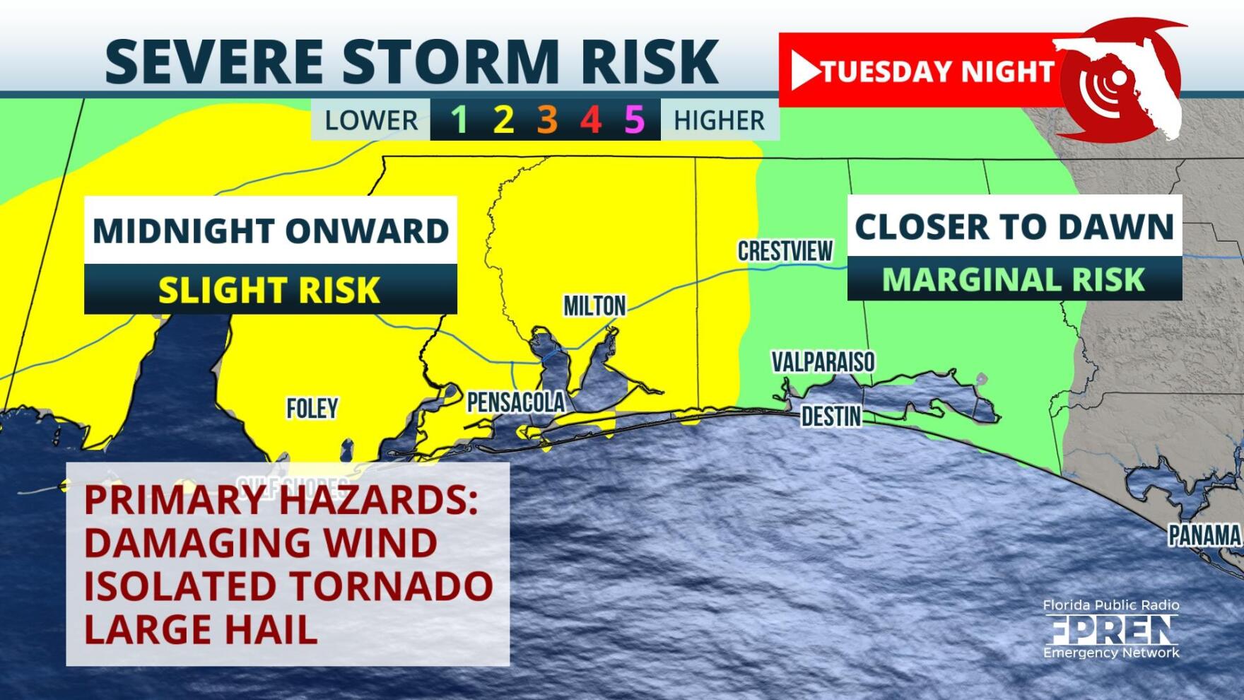
A broken squall line of thunderstorms is expected to move from west to east through Pensacola and Panama City tonight into early Wednesday morning. On top of locally heavy rainfall rates, a few storm cells could become strong enough to produce tornadoes, damaging straight-line winds, and large hail.
 ,That line is expected to move through the Panhandle early on Wednesday and arrive to the Tallahassee area during the late morning. After that it should push toward North Florida near I-10: Downpours are expected to arrive there during the afternoon. At the same, another round of downpours is expected to initiate over the north-central Gulf of Mexico and push onshore near Panama City and Pensacola. Again, locally heavy rainfall will be possible over the Forgotten and Emerald Coasts.
The final round of substantial rainfall is expected to take shape Wednesday evening as troughing in the upper atmosphere is overlaps the stalled surface front. A squall line of gusty thunderstorms should first impact the western Panhandle Wednesday evening, before arriving to the Tallahassee area early Thursday. After that, heavy rain and strong thunderstorms should sweep through the Big Bend, North Florida, and the I-4 corridor Thursday afternoon and evening.
 ,Although rainfall accumulations will vary based on thunderstorm tracks, forecast models hint that 1 to 3 inch accumulations are likely, with locally higher amounts possible. The quick hitting nature of these storms could produce localized flash flooding, especially in urban and low lying areas. This heavy rain is forecasted to impact areas in which drought is developing. Although accumulations won't alleviate the drought, they should help stop it's spread. In addition, the rainfall should assist in taming wildfires that have consumed ~15,000 acres of land in Bay and Gulf counties.
9(MDA5NDY0MjA5MDEzMzcwMjQ4MTUxZWMwMg004))


