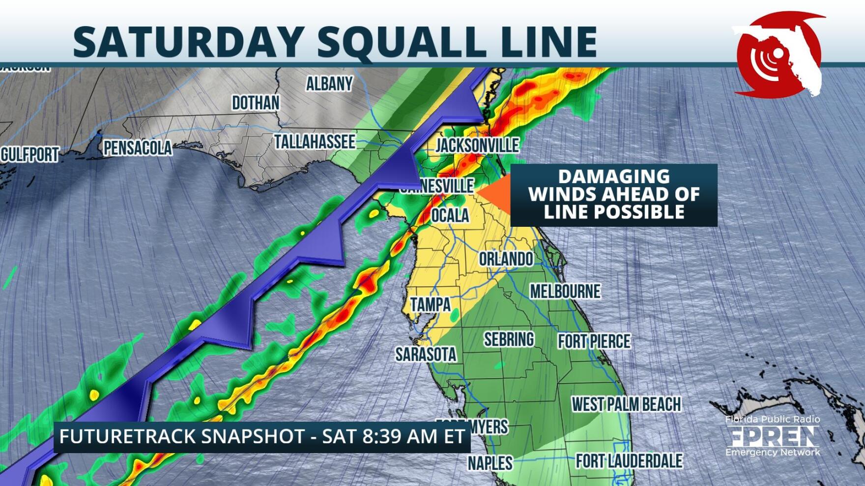
 ,A final round of strong storms is expected to impact the Sunshine State on Saturday, before temperatures plunge to wintertime levels Sunday and Sunday night.
So far this week, a stalled front over the Panhandle has triggered numerous batches of gusty thunderstorms and flooding rain rates across the northern half of the state. Portions of the Forgotten Coast, interior North Central Florida, and the I-4 corridor have reported several inches worth of rainfall accumulations since Tuesday. As of early Friday afternoon, a steady stream of downpours was flowing from the Gulf of Mexico into the northern Florida peninsula, covering that area with 1.5-2" per hour rainfall rates.
The stormy pattern, caused by a mid level energy overrunning the stalled surface front (winds around which have drawn copious moisture over the state), will persist into Friday night. By early Saturday morning, a strong mid level trough is expected to dig into the Central Gulf Coast and approach the area of the surface stationary front. It is at this point that a squall line of strong thunderstorms is expected to develop. The mid level trough should drag the surface front-- and the squall line of storms- through Florida's Panhandle overnight Friday into Saturday, the Big Bend before dawn on Saturday, and North Florida by mid morning. Storms should then traverse the central and southern peninsula Saturday afternoon and evening.
Thunderstorms embedded within the squall line are expected to be strongest overnight Friday and early Saturday morning. Damaging straight-line winds will be likely immediately ahead of the line, and a few tornadoes could briefly touch down. By Saturday afternoon and evening, the surface and upper level features are expected to decouple, and this could lead to weakening of the line.
In addition to wind and tornado threats, this last line of storms should provide another quick hit of excessive rainfall rates. Areas that have already been inundated with heavy accumulations could begin to flood. Areas of particular concern include the peninsula north of I-4 and the Forgotten Coast.
 ,Behind Saturday's squall line, winds are expected to turn northerly, which will quickly flush humidity from the atmosphere and send a cold airmass southward. Highs Sunday afternoon will likely be limited to the low 60s over Central Florida, and the 50s over the Panhandle and the northern peninsula. Overnight Sunday into Monday morning record lows are possible, especially over interior North Florida, and frost will be likely north of I-4.
By midweek, westerly winds in the mid levels should replace northerlies and temperatures should return to near seasonal levels.
9(MDA5NDY0MjA5MDEzMzcwMjQ4MTUxZWMwMg004))
