Strong thunderstorms are expected over the Palmetto State on Friday ahead of a late spring cold front. The storm system is forecasted to push through the Panhandle from west to east during the afternoon and evening Friday, and some of the strongest cells could produce large hail and damaging winds.
Earlier this week, an area of low pressure developed on the leeward side of the Rocky Mountains and pushed into the Central Plains, where it produced numerous reports of hail, damaging winds, and destructive tornadoes Wednesday evening. The same system will track eastward on Thursday and approach the Southeast during the day Friday. Ahead of it, winds should draw elevated levels of humidity into the region, which will prime the environment to sustain thunderstorm activity.
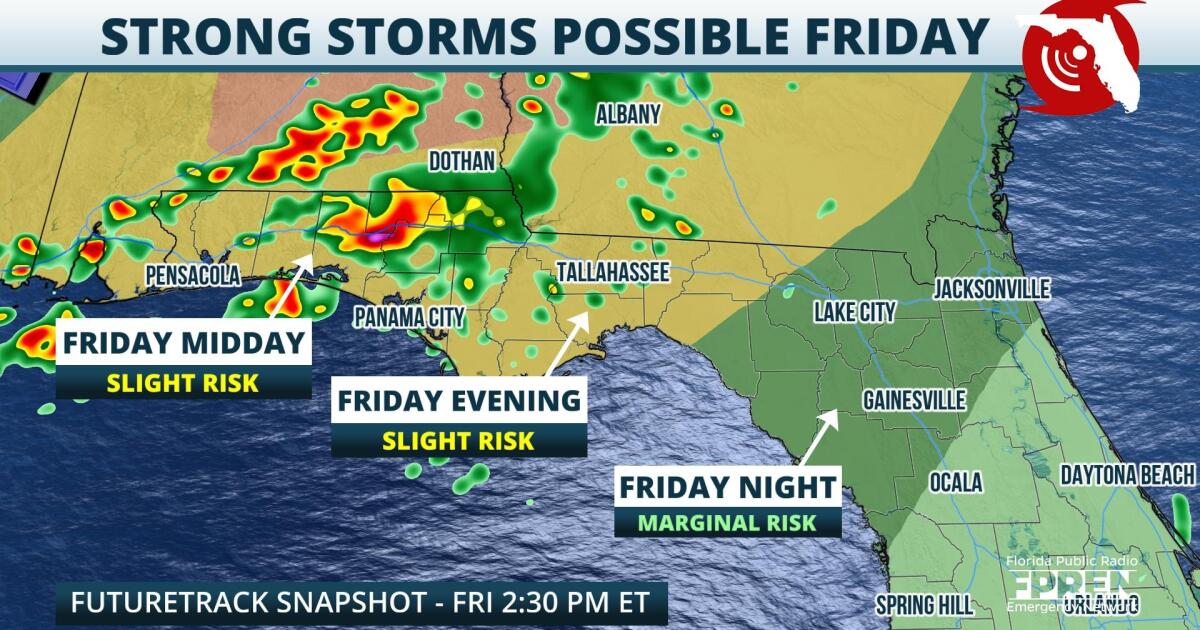
The latest high-resolution models suggest a broken line of thunderstorms will approach the Panhandle by around lunchtime on Friday. Ahead of that, individual cells may bubble up closer to the Forgotten Coast and Big Bend region. The line of storms should approach the Tallahassee area by around sunset, with a gradual overall decrease in instability expected by late Friday evening. A general weakening trend is expected as storms move closer to the Nature Coast and North Florida, but a few storms could still maintain a severe risk in this region.
The Storm Prediction Center has much of the Panhandle west of Tallahassee under a "slight" risk for severe weather, which is a 2 on a 1-to-5 scale. A more supportive environment for more widespread severe weather looks likely in Alabama and Georgia. For cities like Jacksonville and Gainesville, a "marginal" risk for severe weather exists Friday evening, which is a 1 on a 1-to-5 scale. Damaging straight-line winds will be the most likely hazards from these storms, on top of heavy rainfall rates and frequent lightning. In addition, large hail will be possible in the Panhandle. A few isolated tornadoes could also develop, although parameters will likely be more conducive to tornado formation north of the Sunshine State.
A few showers or storms will be possible from the Big Bend region through the Peninsula on Saturday as the cold front eventually stalls. By Sunday, a slightly cooler air mass arrives across North Florida and the Panhandle, with most locations seeing highs fall back into the middle and upper 80s.
9(MDA5NDY0MjA5MDEzMzcwMjQ4MTUxZWMwMg004))


