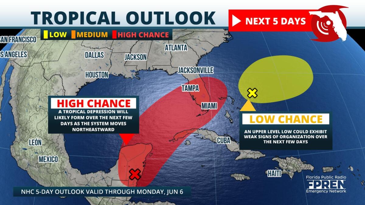
Today, June 1, is the official start to the 2022 Atlantic Hurricane season, and forecasters and the National Hurricane Center are monitoring the western Caribbean for tropical development.
Early on Wednesday morning, the remnants of Hurricane Agatha, a Pacific Basin storm that made landfall over southern Mexico on Memorial Day were located over the western Yucatan Peninsula. Meteorologists at the NHC say that the lingering atmospheric disturbance has a high chance of developing into an Atlantic tropical system once it exits the Yucatan into the southern Gulf of Mexico. However, details regarding intensification, track, and timing remain largely uncertain.
Sea surface temperatures are warm and atmospheric moisture content is high in the western Caribbean. These factors are prime for tropical organization and intensification. Conversely, observations on Tuesday morning indicated high levels of wind shear in that same area, and this can inhibit tropical development. Regarding forecast models, NOAA’s Global Forecast System (GFS) is forecasting a disorganized system that could skirt through South Florida this weekend. The ECMWF or European model favors a stronger system with a more northward track over South and Central Florida. It is imperative to note that these models will continue to change as the week progresses and more data becomes available.
Although many uncertainties persist, there are a few forecast takeaways. Regardless of ultimate track or intensity, interests in the western Caribbean, Florida Keys, and South Florida can expect an uptick in moisture and rainfall chances for the rest of the week. By the weekend, there is a high chance that these areas will receive multiple rounds of heavy rain, which will pose the risk for flash flooding. In addition, strong wind gusts will be likely near the center of the low pressure circulation. More details will become evident over the coming days, and the forecast will be adjusted accordingly.
In addition to the above system, as of Wednesday morning, NHC forecasters are also monitoring a disturbance east of the Bahamas. This weak trough is located in an hostile environment and has a low probability of developing further. It’s general motion will be eastward, farther into the Atlantic.
Now that hurricane season has officially begun, residents are urged to review and finalize their disaster response plans. Additional tips regarding storm and disaster preparedness can be found at ready.gov and floridadisaster.org.
9(MDA5NDY0MjA5MDEzMzcwMjQ4MTUxZWMwMg004))
