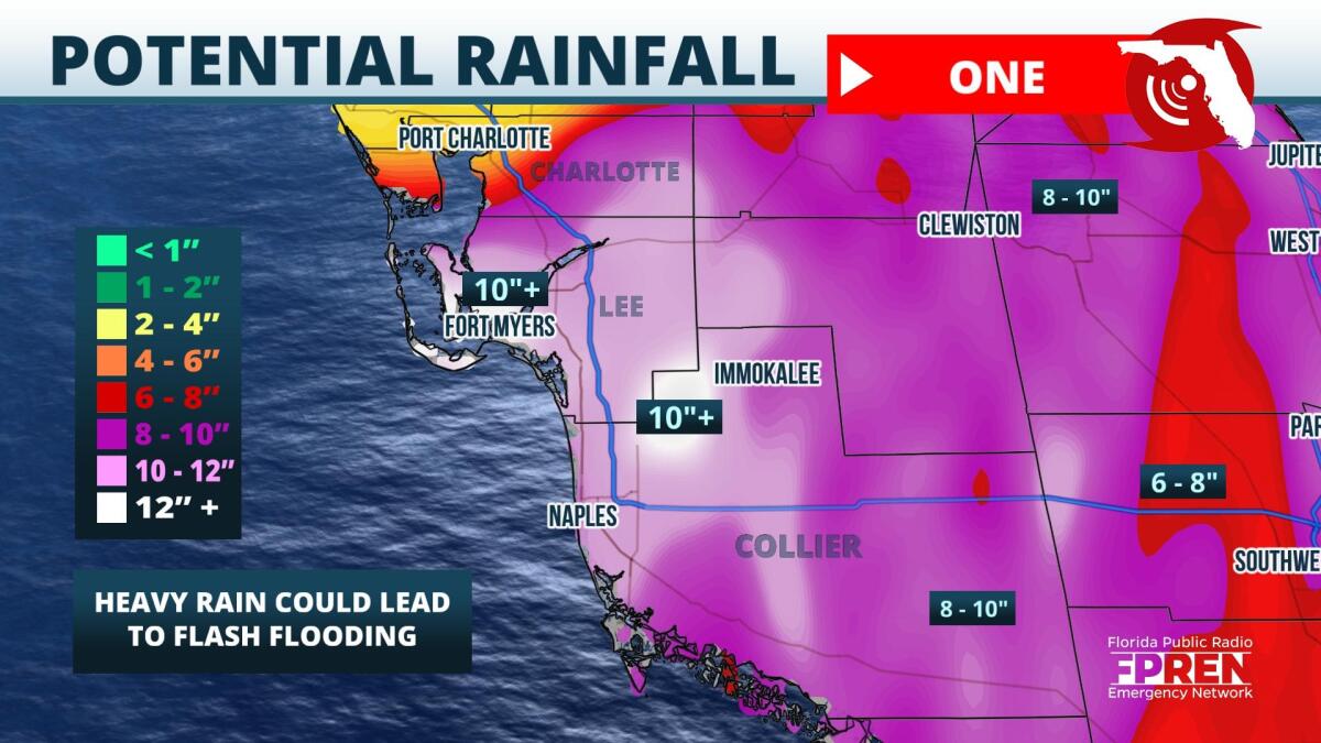
Tropical Storm Warnings are in place across Charlotte, Collier, and Lee Counties ahead of what is expected to become Tropical Storm Alex's arrival Friday into Saturday.
Potential Tropical Cyclone One was located between Mexico's Yucatan Peninsula and the western tip of Cuba late Friday morning. Sustained winds of 40 miles per hour were observed with movement towards the northeast at five miles per hour. While sustained winds do meet the tropical storm status, the convection associated with Potential Cyclone One was poorly organized according to the 10 AM National Hurricane Center advisory. Forecasts issued late Friday morning still indicate the potential for tropical storm status to be attained before making landfall between Port Charlotte and Everglades City Saturday.
The issuance of Tropical Storm Warnings indicates wind gusts of between 39 and 57 miles per hour are expected to occur during the early morning hours Saturday. Wind speed forecasts have remained consistent with previous advisories, resulting in high confidence that winds will remain a lower impact threat than the potential for flash flooding.
Starting Friday night and lasting through Saturday, the risk of flash flooding exists across much of South Florida, especially from Charlotte Harbor to Chokoloskee Bay. Rainfall forecasts indicate the potential of between six and ten inches across Charlotte, Collier, and Lee Counties, with locally higher totals possible near coastal areas. A moderate flash flood risk is in place from Fort Myers south overnight Friday, so residents living in flood-prone locations should closely pay attention to the latest forecasts.
Storm surge is not forecast to become a major threat. The latest guidance indicates a maximum storm surge of one to two feet from Longboat Key to Marco Island. Despite this, normally dry areas near the immediate coastline will likely become inundated due to a combination of storm surge and the tidal cycle through Saturday.
Much of southwest Florida will be on the east side of Potential Cyclone One. This places much of the region in a favorable position for isolated tornadoes. Brief tornadoes or waterspouts could occur from Sanibel Island to the Ten Thousand Islands National Wildlife Refuge. Tornado warnings associated with tropical systems tend to be issued with little time to take shelter, so it is important to act quickly if warnings are issued. The risk of tornadoes will be in place Friday night through early Saturday.
Official forecast guidance shows likely Tropical Storm Alex pushing off the Florida Peninsula by Saturday evening, with conditions locally improving by Saturday afternoon.
9(MDA5NDY0MjA5MDEzMzcwMjQ4MTUxZWMwMg004))
