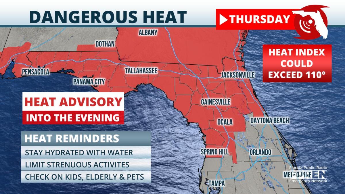
A Heat Advisory has been issued for North Florida and the Panhandle, effective through Thursday evening.
High pressure building throughout the atmospheric column will continue to cause temperatures to rise across the Sunshine State on Thursday. Afternoon highs over the northern half of the state could reach levels five to 10 degrees above normal, in the upper 90s. In addition, a more humid airmass is expected to arrive to the region by Thursday afternoon, and this should cause the heat index, which considers factors like temperature, relative humidity, and wind speed, to surpass 100 degrees. In some parts of North Central Florida, afternoon "feels-like" temperatures could exceed 110 degrees for several hours Thursday afternoon. Similar conditions are expected on Friday.
 ,Shower and thunderstorm chances will rise as humidity levels rise over the state, and rainfall could provide temporary relief from the heat during the evening. However, hot temperatures preceding storm development could enhance their strength: Damaging winds, frequent lightning, and excessive rainfall rates will be possible from storms both Thursday and Friday.
By the weekend, a front should approach from the north. Rain chances should increase over the northern half of Florida, and afternoon temperatures should return to more seasonable levels.
9(MDA5NDY0MjA5MDEzMzcwMjQ4MTUxZWMwMg004))


