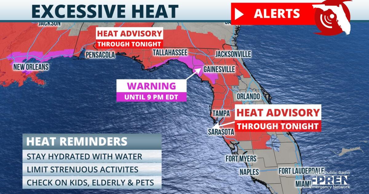
Excessive heat and strong thunderstorms are in the forecast for many Floridians this afternoon.
As of Friday morning, Heat Advisories had been issued across most of the Sunshine State, from the Panhandle to Central and South Florida. In these locations, afternoon highs are expected to reach the mid to upper 90s. Humidity levels are expected to rise over the region, and this will cause heat index values to range between 10 and 15 degrees above actual temperatures. For several hours this afternoon, “feels like” temperatures could hover near 110 degrees. Along the Nature Coast, heat index values could reach 115 degrees. An Excessive Heat Warning is in effect from Franklin County to Levy County.
 ,In addition to the dangerous heat, strong thunderstorms are expected to threaten the Florida peninsula this afternoon. Locations from Tallahassee to West Palm Beach are under a Marginal Risk (level one out of 5) for severe thunderstorms Friday afternoon and evening, according to meteorologists at the Storm Prediction Center. The oppressive heat and humid atmosphere is expected to prime the environment for widespread storm development as the Gulf and Atlantic sea breezes migrate inland during the afternoon. In addition, a stalling frontal boundary near the Florida/Georgia border could provide storms with additional energy for intensification. The primary hazards from the strongest storms on Friday will likely be damaging winds and frequent lightning. As the environment is moisture-rich, flooding rain rates are possible too.
Storm chances should remain elevated each afternoon this weekend. However, the heat wave is expected to abate as the mid-level ridge responsible for the above average temperatures migrates westward out of the southeastern United States.
9(MDA5NDY0MjA5MDEzMzcwMjQ4MTUxZWMwMg004))
