English English Spanish Español
Powered by WUFT
Temporarily change filter
Finding your station

July Fourth Outlook

June 29, 2022
July Fourth Outlook

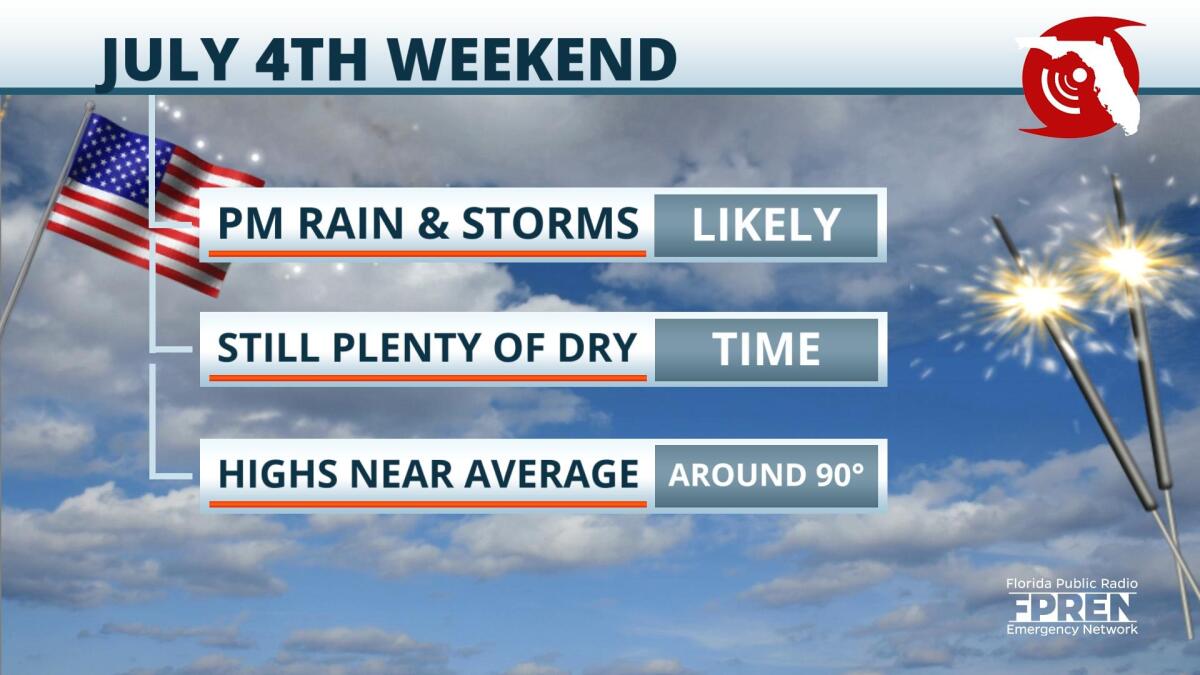
Your holiday weekend weather will be nothing we’re not used to…scattered afternoon and early evening t-storms that will mostly decrease after sunset. Occasional showers may put a temporary damper on your outdoor plans, but don’t go canceling anything.

Saturday through Monday, rain chances will range anywhere from 40-60% with the highest probability of stormy weather on Saturday. There are no tropical systems or other big weather features that will cause the weekend to be a washout. But a few disturbances in the weather pattern may enhance the afternoon and early evening activity a bit more.

Make sure you head indoors when the weather takes over, and you should be able to get back to the outside fun after not too long.

LOCAL ALERTS
WEATHER
NEWS
TRAFFIC
Sources include nearest National Weather Service office, National Hurricane Center, and the Florida Public Radio Emergency Network (@FloridaStorms).
Sources include nearby emergency management agencies, FEMA, and your local NPR affiliate. 
Sources include the Florida Department of Transportation, Florida Highway Patrol and other nearby traffic information.

1885 Stadium Road
PO Box 118405
Gainesville, FL 32611
(352) 392-5551

A service of WUFT at the University of Florida College of Journalism and Communications 

Partners of the Florida Public Radio Emergency Network include: Florida's Division of Emergency Management, WDNA (Miami), WFIT (Melbourne), WMFE (Orlando), WFSU (Tallahassee), WGCU (Fort Myers), WJCT (Jacksonville), WKGC (Panama City), WLRN (Miami), WMNF (Tampa-Sarasota), WQCS (Fort Pierce), WUFT (Gainesville-Ocala), WUSF (Tampa), WUWF (Pensacola) and Florida Public Media.

Loading...
linkedin facebook pinterest youtube rss twitter instagram facebook-blank rss-blank linkedin-blank pinterest youtube twitter instagram