A disturbance in the Gulf of Mexico is being monitored for tropical development later this week, and it could result in flooding rains in portions of the Panhandle.
Surface analysis early Monday afternoon revealed a trough of low pressure stretching from the Florida Panhandle to the east-central Gulf of Mexico. Infrared satellite and radar imagery depict abundant convective activity in association with this trough, with buoy data suggesting seas of two to four feet in this area. While the overall odds of tropical development are modest, the system could become better organized if it remains offshore over the northern Gulf of Mexico.
The environment for tropical development is favorable in the Gulf of Mexico, which is why this disturbance deserves close attention. Sea surface temperatures are upwards of 90 degrees in the northern Gulf, which is some of the warmest water in the Atlantic Basin.
Upper-level winds are generally light, with a pocket of minimal wind shear over the Southeastern U.S. Unlike severe thunderstorms in the spring, which thrive on changing winds with height, tropical development will virtually be non-existent in the presence of strong wind shear.
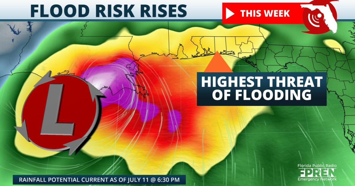
Exact rainfall totals will be determined by where the heaviest rain axis treks, with models disagreeing on where that takes place. One model indicates the system spending more time over land, which would cut down on potential tropical development. However, this scenario would maximize rainfall totals. Another model indicates a higher likelihood of the system remaining offshore, which would reduce the overall rain totals. Despite the uncertainty, widespread rain amounts of more than six inches are possible along the Emerald Coast over the next seven days. This risk will become especially realized in locations that experience heavy and repeated downpours day after day.
,Regardless of potential tropical development, impacts are still expected in the Panhandle. A similar atmospheric setup was in place across Louisiana in August 2016, resulting in record flooding of more than 20 inches in the Baton Rouge area. According to the National Weather Service, the likelihood of that much rain occurring in just a few days was one-tenth of one percent. While no two weather systems behave exactly the same, the events of August 2016 underscore the importance of not getting caught up in whether a system is named or not.
9(MDA5NDY0MjA5MDEzMzcwMjQ4MTUxZWMwMg004))


