Flash flooding will be possible over the Panhandle through the end of the workweek. The threat arises from increasing Gulf moisture overhead and an uptick in sea breeze thunderstorm activity.
On Wednesday morning, upper level energy was still present over US Southeast and southerly winds in the lower levels of the atmosphere were driving Gulf moisture onto the Panhandle. These features are expected to persist over the region through the end of the workweek, and enhance typical sea breeze shower activity.
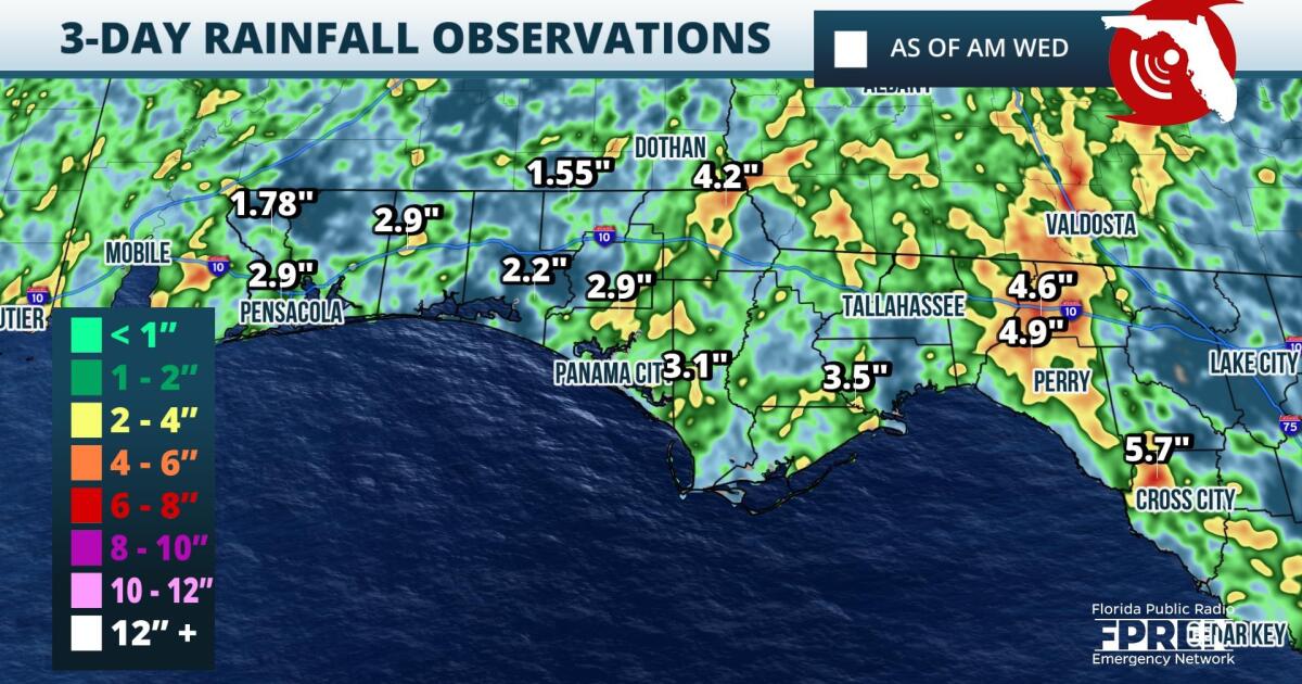
Numerous clusters of thunderstorms are modeled to develop and move generally from south to north over the Panhandle during the late morning and throughout the afternoon Wednesday through Friday. Locally heavy rainfall rates, on the order of two inches an hour, will be possible at times. Some locations, especially near Tallahassee and the Forgotten Coast, have already received several inch accumulations this week and additional rainfall could overwhelm the environment.
,Forecasters at the Weather Prediction Center place the westernmost Panhandle under a slight (level 2 out of five) risk for flash flooding on Wednesday. The rest of the Panhandle is under a marginal (level one out of five) risk Wednesday through Friday.
,Residents are reminded to follow the proper procedures should flooding occur in their area: Always seek higher ground and never drive through flooded roadways.
9(MDA5NDY0MjA5MDEzMzcwMjQ4MTUxZWMwMg004))


