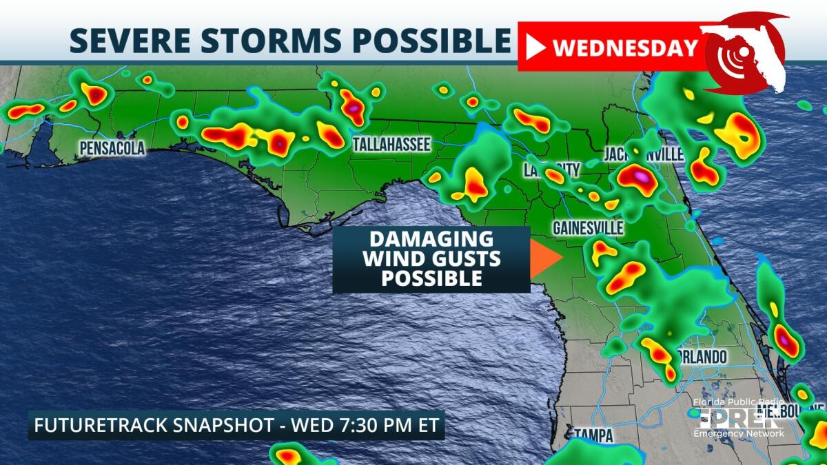
Strong thunderstorms are possible across North Florida and the Panhandle on Wednesday. Although isolated tornadoes and small hail could develop from the most intense cells, damaging straight-line winds will be the primary hazard.
Earlier this week, a cold front pushed from the Ohio River Valley into the Tennessee Valley and Mid-Atlantic states. Interactions along and ahead of the boundary spawned clusters of severe thunderstorms, some of which produced hail and damaging winds over eastern Kentucky, Tennessee, and the foothills of the Carolina Appalachians. In addition, these storms dropped several inches of rainfall over portions of West Virginia and the Carolinas, which resulted in localized flash flooding.
,On Tuesday morning the front was sagging from the Mid Atlantic into northern Georgia and Alabama. The front is forecasted to continue migrating southward throughout the day, stalling in the vicinity of North Florida by Wednesday. As this occurs, column moisture levels over the northern half of the state are expected to substantially increase. Weak boundary interactions, increasing humidity levels, and daytime heating should all contribute to increase the scope and intensity of afternoon thunderstorm activity on Wednesday, especially near the I-10 corridor and along the spine of the peninsula.
Latest high resolution model guidance suggests that storms could initiate within a few hours of noon Wednesday, but they are more likely to become numerous during and after the evening commute. Fragmented lines of thunderstorms should progress from northwest to southeast during the evening, and a few clusters could persist over Central Florida into the pre-dawn hours Thursday. Heavy rain rates, local flooding, frequent lighting, and damaging wind gusts will all be possible from these storm cells.
The frontal boundary is expected to stall over North Florida through the end of the workweek, which should result in a persistent unsettled pattern across the region. Conditions should remain hot and humid, and each day through at least the weekend, evening thunderstorms are expected to become widespread.
9(MDA5NDY0MjA5MDEzMzcwMjQ4MTUxZWMwMg004))


