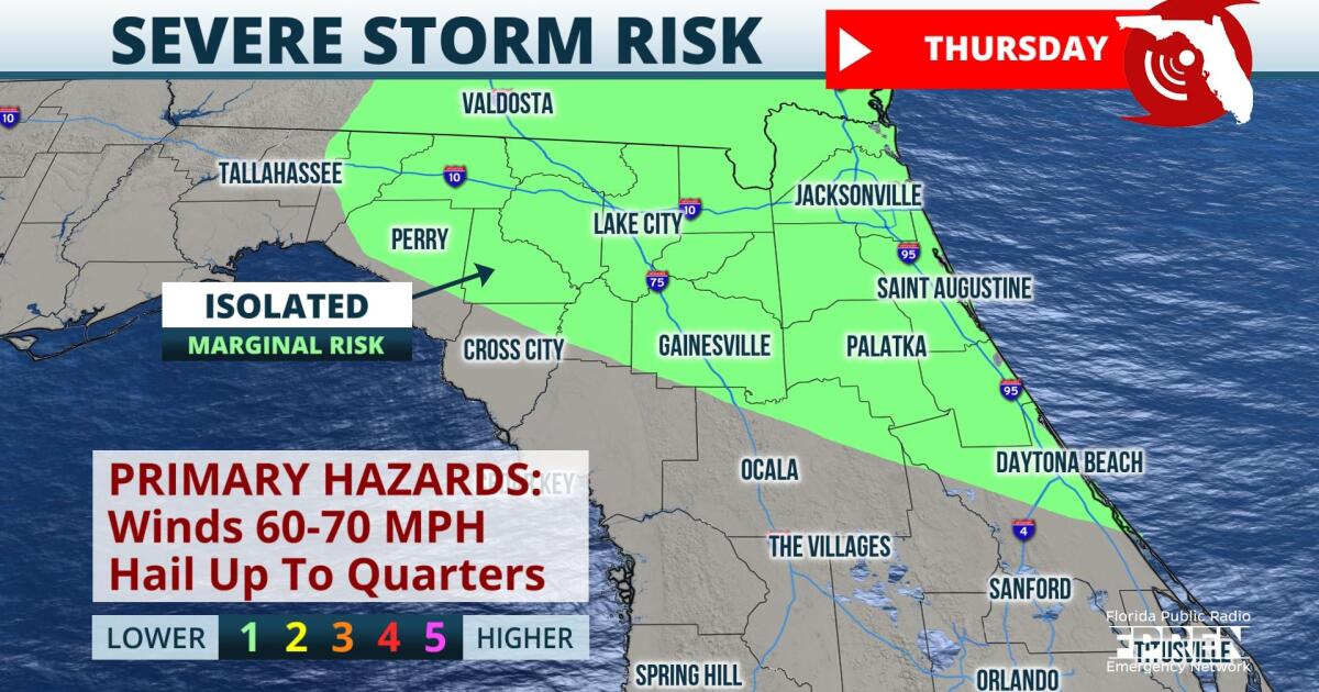
Parts of North and Central Florida may get several rounds of strong to severe storms through tomorrow evening. Due to a cool front settling into northern parts of the state, storms will have a little more punch than our typical summertime activity.
 ,Expect scattered t-storm coverage across the panhandle into North Florida and down the Space Coast into this evening. The strongest t-storms may produce isolated wind gusts up to 70 mph and several inches of rain very quickly. So please be careful and watch for high water as you’re making your evening plans.
 ,More rounds of strong to severe storms are possible tomorrow too, as that front and some upper-level energy will work together to keep those dangerous storms around.
9(MDA5NDY0MjA5MDEzMzcwMjQ4MTUxZWMwMg004))


