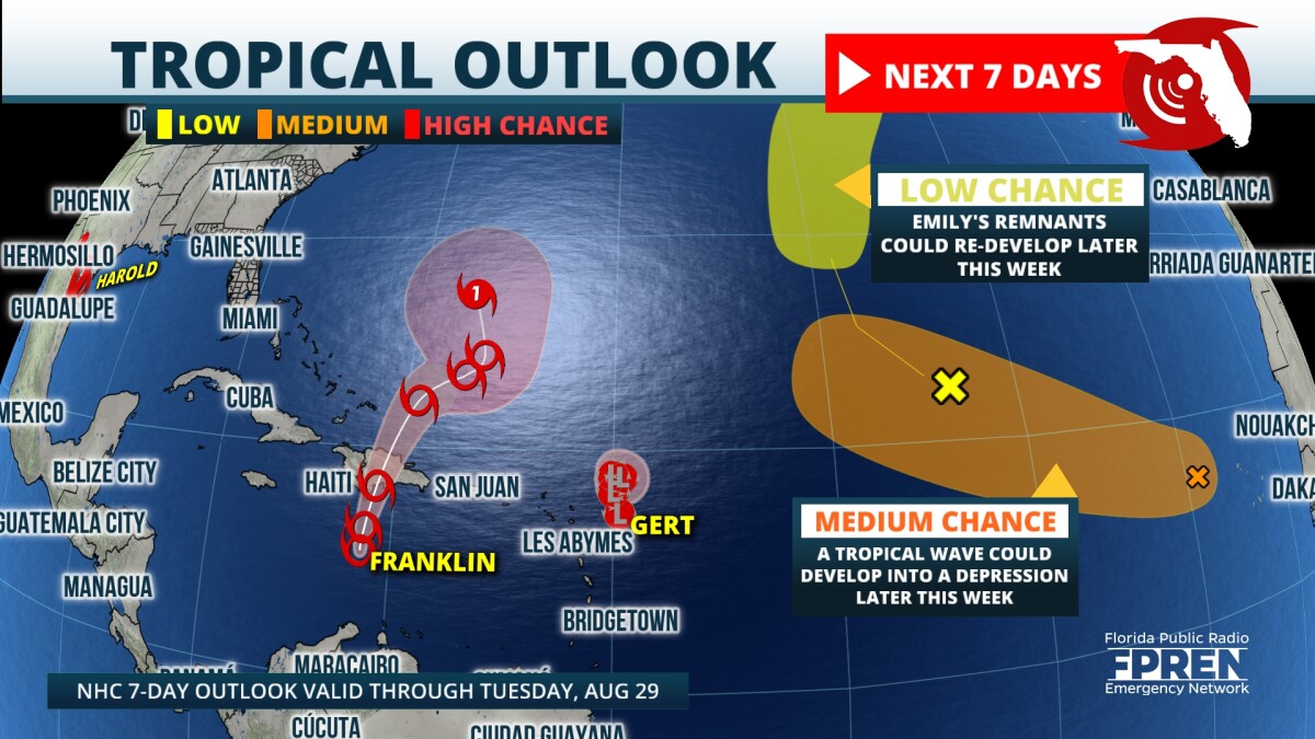
Tropical Storm Harold made landfall on Padre Island late this morning with max sustained winds of 50 mph. According to Colorado State University’s Phil Klotzbach, only 6 other years on record had 9 or more named storms by August 22nd. Overnight, Harold was the 4th Atlantic storm to form in just 39 hours. Klotzbach also emphasizes this is the fastest time on record for 4 Atlantic named storm formations, breaking records set in 1893 and 1980.
 ,Harold has already caused significant flooding and isolated tornadoes across parts of south Texas. On average, 3-7” of rain will fall across that area the next several days as the storm tracks slowly westward and weakens.
Elsewhere, Tropical Storm Franklin will continue to bring flooding rains and tropical storm conditions to parts of the Greater Antilles the next several days. Franklin is still forecasted to head north-northeast and likely turn into a weak hurricane this weekend. Although the track and intensity remain uncertain afterwards, no direct impacts are expected along the U.S. East Coast.
 ,A large area of high pressure will strengthen across the Atlantic this week creating unfavorable conditions for tropical development. Post-Tropical Cyclone Gert just east of the Lesser Antilles should gradually weaken the next couple days. The circulation will open up into a weak wave then slowly dissipate soon after. Two other disturbances will track north and west through the central Atlantic but will struggle due to that high pressure.
Hurricane season still has a ways to go and we expect things to stay active, so please get the Florida Storms app to keep your safe and informed at all times.

9(MDA5NDY0MjA5MDEzMzcwMjQ4MTUxZWMwMg004))
