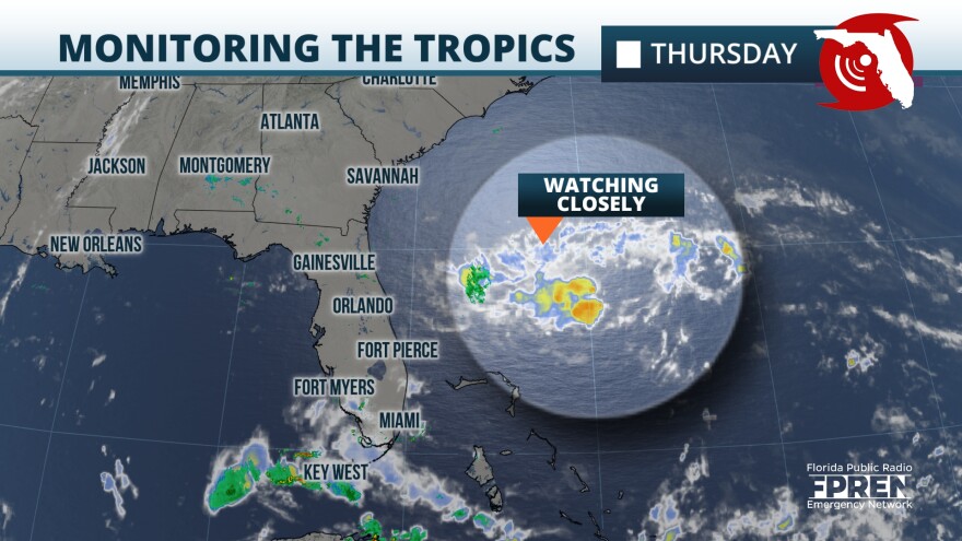
We continue to monitor the development of a disturbance that is a couple of hundred miles east of Cape Canaveral, Florida. It has a medium chance of becoming a tropical system, possibly a tropical depression at best, as it will battle a pocket of dry air and limited time before its chances quickly become depleted and move over land. The tropical disturbance is moving west-northwest between 10 and 15 mph, and it will likely reach the northeastern Florida coast of southern Georgia coast on Friday. The next name on the list is Beryl.
Hurricane Hunters have been investigating this system on Thursday afternoon and have not found that the system has a well-defined center of circulation and satellite imagery finds that the storms are very disorganized. Some storms will be moving onshore, fast. Expect rainfall totals of around 2 inches in parts of Central and North Florida, with gusty winds at times. This compact system will not bring widespread severe weather but it will bring more problems to the marine sectors for boaters and beachgoers as well as for swimmers. Friday will not be the best or safest day to be on the water or swimming anywhere along eastern Florida through the Carolinas’ coastline.
4:20PM 6/20 | We continue to monitor a disturbance in the Atlantic which will arrive early Friday. This will bring a period of showers from Orlando to Cape Canaveral northward, as surf and marine conditions remain hazardous. Chance of development still 40%. #FLwx pic.twitter.com/LQ5RejBA1e
— NWS Melbourne (@NWSMelbourne) June 20, 2024
Threats for the eastern Florida Coast through Friday evening:


