The tropical wave that has been drenching parts of South Florida, the Keys, and the western half of the Florida peninsula may be the next system to organize into a tropical depression this week.
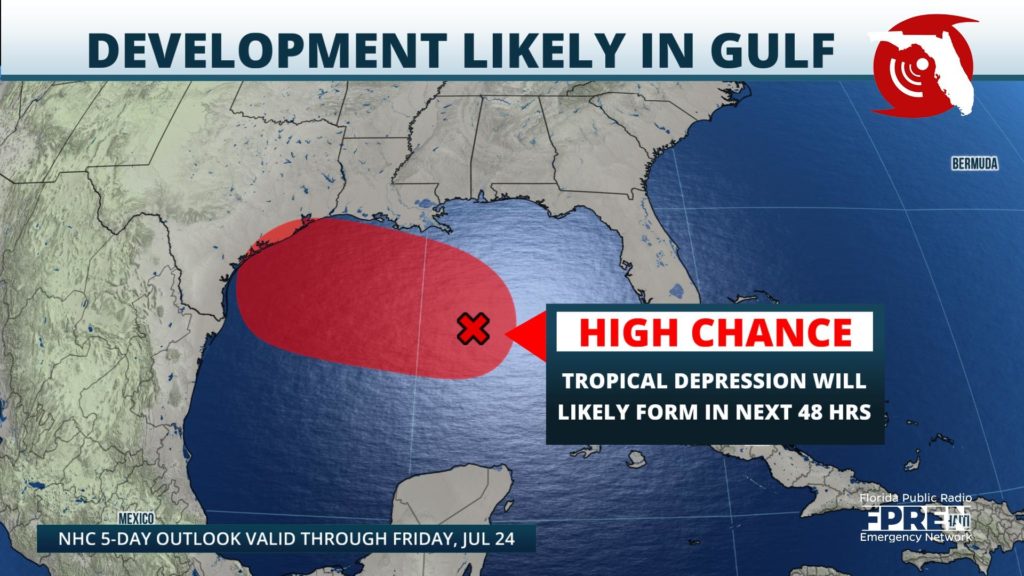
As of the National Hurricane Center's early afternoon update, the disturbance has an 80 percent chance of achieving depression classification Thursday or Friday. If the system is able to reach tropical storm status, its name would be Hanna. Regardless of its development, higher-than-usual shower activity is forecast over Florida for another day. The western Panhandle may also see an increase in downpours on Thursday before the system moves farther away from the state.
The flow around a large ridge of high pressure over South Carolina is steering the system westward. Most reliable computer models show the developing system reaching the Texas Gulf coast later Friday or early Saturday. Widespread rainfall amounts of 2 to 4 inches, with locally higher amounts, may cause areas of flooding from southern Louisiana to the Texas Gulf coast over the weekend.
Strong winds and substantial surge appear unlikely, assuming the tropical system stays weak based on the latest forecasts.


