Tropical Storm Isaias is expected to move along the Florida Atlantic coast today from Palm Beach county northward toward the Space Coast today and tonight with tropical storm force winds, locally heavy rain, and rough seas.
Tropical Storm Isaias is expected to move along the Florida Atlantic coast today from Palm Beach county northward toward the Space Coast today and tonight with tropical storm force winds, locally heavy rain, and rough seas.
The Tropical Storm is expected to be at its closest approach to the First Coast late Sunday night and Monday morning before departing for the Carolinas. Conditions are expected to gradually improve late Monday afternoon and evening.
NO CURRENT STORMS IN ATLANTIC BASIN
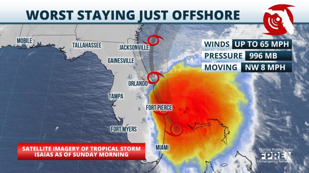
Isaias weakened slightly more overnight; top sustained winds are near 65 mph as of the early Sunday morning advisory from the National Hurricane Center. Hurricane Warnings have been changed to Tropical Storm Warnings from Hallandale Beach northward along the Florida east coast. Inland Tropical Storm Warnings are also in effect from Palm Beach county north to the Orlando and Jacksonville metropolitan areas. Occasional tropical storm force winds are likely in the warning areas as bands develop and move inland Sunday into Sunday night.
Storm Surge Watches continue from St. Augustine southward, where 2 to 4 feet of water are possible in areas of typically dry land somewhere within the watch area. The times of high tide are around sunrise and sunset, which is when the inundation is most likely to occur.
Rainfall amounts of 2 to 4 inches are forecast generally along the I-95 corridor and eastward to the immediate coast, with isolated amounts of up to 6 inches possible based on the latest National Hurricane Center forecast. 1 to 2 inches are forecast west of I-95 in places.
Areas farther west outside of the tropical storm warning area may also see occasional rain bands later today and into Monday morning; however, wind gusts are forecast to stay between 15 and 30 mph.