A Tornado Watch has been issued for parts of the Florida Panhandle until 4:00PM CDT.
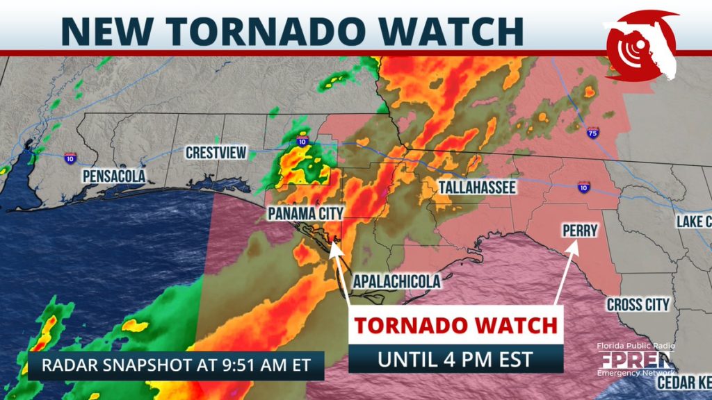
The watch is valid for the following counties: Franklin, Gadsden, Leon, Liberty, Wakulla, Bay, Calhoun, Gulf, and Jackson. This includes the city of Tallahassee.
A line of strong showers and thunderstorms associated with an approaching cold front will be slowly pushing eastward through the Florida Panhandle Thursday morning and afternoon. A few storms have the potential to produce strong straight-line winds, small hail, and isolated tornadoes. Flash flooding will also be a concern for regions that pick up heavy amounts of rainfall.
It is recommended that residents have multiple way of receiving weather warnings throughout this event. One available resource is the Florida Storms mobile app, a free service of the Florida Public Radio Emergency Network.


