Tropical Storm Warnings have been issued for parts of the central Gulf coast ahead of Potential Tropical Cyclone Three, which is expected to be the first tropical storm to impact the United States this year.
While the center of the Potential Tropical Cyclone is forecast to remain west of Florida, the majority of the rain is likely to be sheared east, away from its center of circulation.
Heavy rain is expected along the Gulf coast from Louisiana to the Florida Panhandle, starting Friday afternoon and lasting into at least Saturday night. Many of these areas have received double their average rain this spring, making the region susceptible to fresh water flooding. An additional 5 to 10 inches of rain is forecast, with locally higher amounts possible, which could lead to flash flooding
A Tropical Storm Warning has been issued from Intracoastal City, Louisiana, to the Alabama/Florida border. While the western Florida Panhandle is not under a Tropical Storm Warning as of Thursday evening, a Flash Flood Watch is in effect for the counties of Escambia, Santa Rosa and Okaloosa which includes the cities of Pensacola, Milton and Destin.
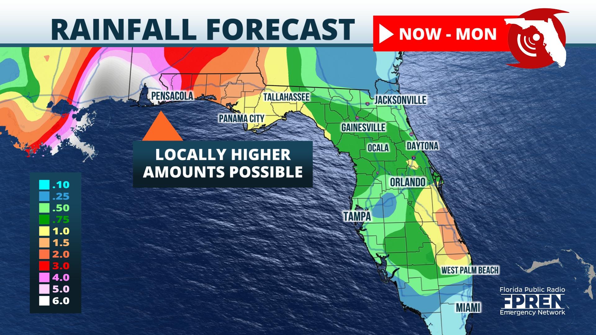
Heavy rainfall associated with the developing tropical system is anticipated to spread inland Friday night through at least Saturday night producing rainfall totals of 4 to 8 inches, with locally higher amounts in excess of 10 inches possible.
A Hurricane Hunter reconnaissance aircraft investigated the tropical disturbance Thursday afternoon and evening to determine the approximate location of the center of circulation. Initial data from the first Hurricane Hunter mission found a barometric pressure of 1008 mb and maximum sustained wind speeds near 30 mph. The Potential Tropical Cyclone as of the Thursday 5:00PM EDT Advisory from the National Hurricane Center was moving north at 9 mph.
Potential Tropical Cyclone Three is expected to continue strengthening and projected to become a Tropical Storm by Friday before impacting the Gulf coast. The name "Claudette" will be given to the storm once it reaches Tropical Storm strength.


