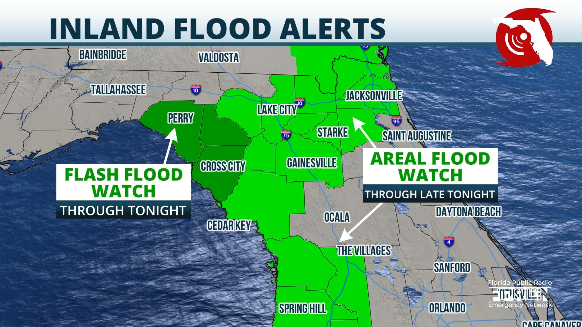
Flooding is ongoing in several counties along Florida's Nature Coast, where more rounds of heavy rain are expected through Thursday evening.
A Flood Warning was issued for Citrus, Hernando, Sumter and Pasco counties Wednesday afternoon, then later extended through at least noon Thursday due to multiple reports of urban and street flooding from local emergency managers.
https://twitter.com/FloridaStorms/status/1423150138231508993?s=20
Radar estimates and reporting stations indicate 5 to 9 inches of rain has fallen in the warned area since Monday, with several more inches possible Thursday.

The heaviest rain Thursday is expected immediately along the Gulf Coast from Tampa to Cedar Key, extending north into the Suwannee River valley where an additional 3 to 4 inches are possible. Additional rainfall amounts of 1 to 2 inches are expected in areas farther inland to roughly the I-75 corridor north of the Florida Turnpike, then north and west along I-10 to Florida's Big Bend and Tallahassee.
Many rivers and streams in the area are already above or expected to rise above flood stage, and river flood warnings continue until further notice for the following locations:,
The flood and flash flood watches originally issued Tuesday along Florida's Forgotten Coast, Big Bend, and Nature Coast regions were extended until Thursday evening. The watch was also expanded south to include the Tampa, Saint Petersburg and Sarasota metro areas. The downpours weren't as widespread or as heavy as expected across inland areas of North Florida such as Lake City, Gainesville and Ocala Wednesday. As a result, the Flood Watch was allowed to expire in those locations Wednesday evening.
A nearly stationary front draped across the Florida Panhandle and into southern Georgia has been the catalyst to this week's soggy weather pattern across Florida. Multiple disturbances moving along this boundary have drawn deep amounts of tropical moisture in from the Gulf of Mexico on the heels of a persistent southwesterly flow. Forecast data suggests the front and attendant moisture pipeline will weaken some by Friday or Saturday, allowing a more typical sea breeze pattern to unfold over the weekend. This will result in a more spotty and brief nature to the downpours and gradually allow flood waters to recede.
9(MDA5NDY0MjA5MDEzMzcwMjQ4MTUxZWMwMg004))
