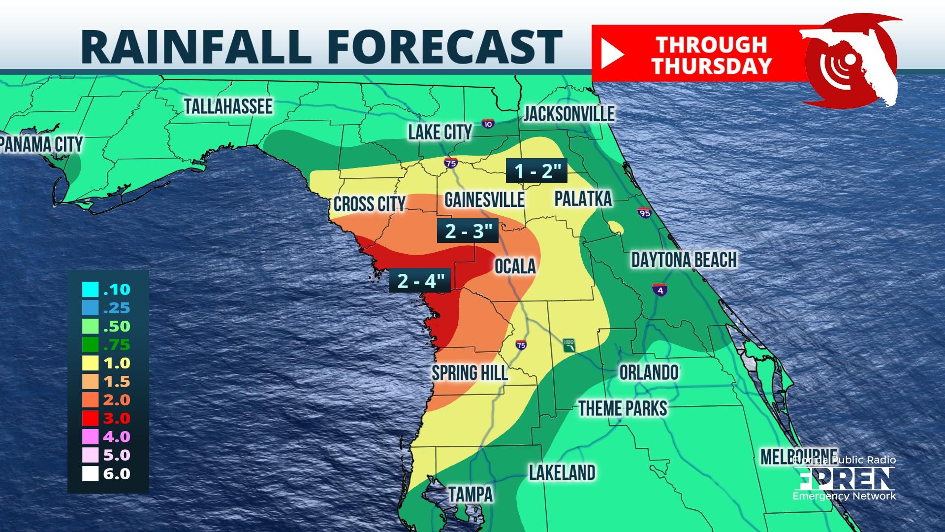
Ida’s remnant moisture is set to move into North Florida Wednesday, following a few recent days of drier weather. Flash flooding could occur in some locations west of I-75 from repeating rounds of heavy rain.

Numerous showers and thunderstorms are expected along the Nature Coast by the morning commute. This activity is then likely to track eastward toward the I-75 corridor by late morning. In the afternoon, storm coverage should become more widespread for areas farther south and east toward The Villages and Crystal River.
Rainfall totals between 3” and 5” are probable near Cross City and Cedar Key, with lesser amounts of 1” and 3” likely across inland areas near Gainesville and Ocala. The greatest risk for flash flooding is near the Big Bend and Nature Coast regions, where multiple rounds of heavy downpours are expected.
Rain chances will remain elevated Wednesday evening into Thursday morning as a frontal boundary sets up across the Florida Georgia border. A brief pocket of drier air should arrive late Thursday night as Ida tracks into the Atlantic. Rain chances will then be kept to a minimum Friday as drier air moves in from the north. This drier air has the potential to last through the weekend.
