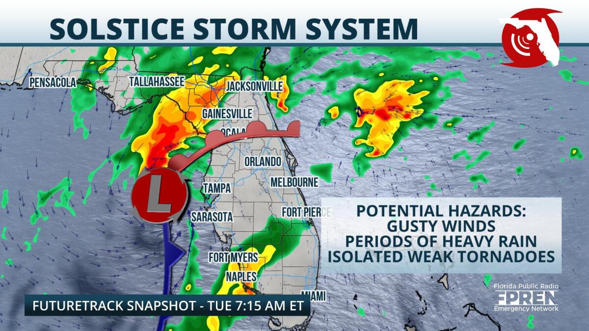
A developing nor'easter is set to track through Florida on Tuesday, bringing with it the chance for damaging winds and isolated tornadoes.
On Monday afternoon, a mid level low was strengthening over Central Texas, while a surface low was developing closer to Louisiana. These two systems will move closer to Florida on Monday night and push over the state on Tuesday. As they approach and track overhead, clusters of heavy rain and a few thunderstorms, some of them strong, are expected impact most of the Florida peninsula. Rain showers are expected to first arrive to North Florida shortly after midnight Tuesday. Then, closer to dawn, heavier rain should push into the coast near Tampa, Fort Myers, and Naples and then track eastward. Rounds of rain are expected to continue across the entire Florida peninsula throughout the day on Tuesday.
Thunderstorms in the direct vicinity of the surface low could become severe during the mid-morning hours across the Nature Coast, Sun Coast and Cultural Coast. In these locations damaging wind gusts and a few brief tornado spin-ups are possible. In addition, storms associated with the system's trailing cold front could produce damaging straight-line winds and isolated tornadoes during the late morning. These storms are most likely to be located in the area of Fort Myers between 6 and 9 AM Tuesday, and the Miami metro area closer to lunchtime.
The surface low and trailing cold front should exit the state during the second half of the day Tuesday, and aside from the presence of a few residual showers, rain chances will diminish. However, a low level jet is expected to persist over South Florida Tuesday evening, which will likely lead to breezy conditions- winds could gust to 30 mph- over that area through Wednesday.
In the wake of the storm system, cooler and drier air should briefly arrive to the state by Wednesday. High temperatures Wednesday will range from the upper 50s in the Panhandle to the mid-70s in South Florida, which is a slight cooldown from what previous weeks.
9(MDA5NDY0MjA5MDEzMzcwMjQ4MTUxZWMwMg004))


