 ,A hard freeze is expected Saturday night across North Florida and the Panhandle. In addition, lows in the 30s are likely across Central and South Florida. These frigid temperatures will be the result of yet another winter cold front traversing the Sunshine State.
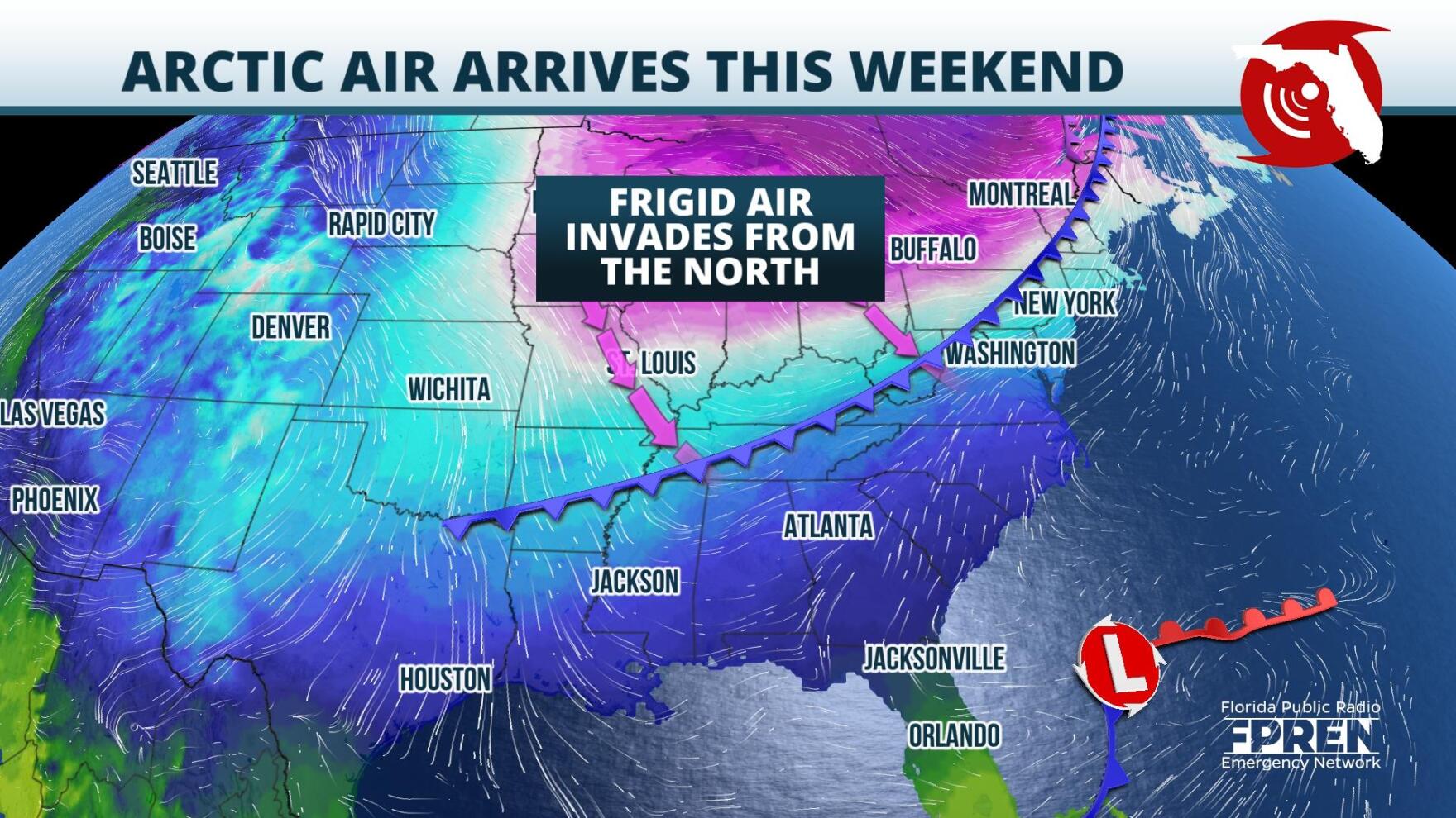
On Wednesday evening, a weak area of low pressure was centered east of the Florida peninsula. At the same time, a powerful low that extended deep into the vertical profile of the atmosphere was centered over western Ontario. Over the next few days, the latter storm system is expected to push a cold front and Arctic airmass through the Upper Plains, Midwest, and toward the Lower Mississippi Valley. During that time frame, the low off Florida’s Atlantic coast is expected to strengthen. Circulation around it will help to pull the cold front frigid air from the Lower Mississippi into the Sunshine State.
The front will likely first arrive to the Pensacola area early Friday evening, before traversing through the Panhandle and into North Florida overnight into early Saturday morning. It is then expected to track through Central Florida, and clear South Florida by late Saturday morning.
There is lack of consensus among the forecast models regarding precipitation accompanying the front: Some project a dry passage while others forecast shower activity along the leading edge of the boundary. Observational data on Wednesday afternoon indicated limited moisture availability over the Panhandle and North Florida. However, atmospheric profiles over Central and South Florida were supportive of some rain showers. If this setup holds, the best chance for showers on Friday and Saturday will be over the Southern half of the state.
Behind the front, an Arctic airmass should cause temperatures to plummet to well below average levels. Winds will likely be blustery across the state on Saturday afternoon and highs could run 20° below normal: Highs in the Panhandle are expected to crest in the upper 40s and low 50s. In Miami, highs might not reach 50°.
Winds should calm over North Florida on Saturday night, and with clear skies, that will set the stage for frigid lows. In the Panhandle and North Florida, lows are expected to plummet to the mid/lower 20s. Should these temperatures persist for three or more hours, it will be considered a hard freeze. In Central Florida, lows on Sunday morning could drop to freezing while in South Florida, they will likely be in the upper 30s.
Temperatures Sunday should stay below normal, but a gradual warm up is expected to ensue next week. By Tuesday, highs are forecasted to be in the 70s across the majority of the state.
9(MDA5NDY0MjA5MDEzMzcwMjQ4MTUxZWMwMg004))


