 ,Another temperature drop is expected across the Sunshine State this weekend after a few days of above average warmth.
On Friday afternoon, a slow moving cold front was draped across Florida's Suwannee River Valley, producing scattered showers and a few thunderstorms to the region. This front is part of a massive storm system that spans the length of the eastern U.S.
from Maine to the Gulf Coast. Thunderstorms are expected to slowly march through the remainder of the Florida peninsula Friday night and Saturday, eventually exiting into the Atlantic Ocean Saturday night.
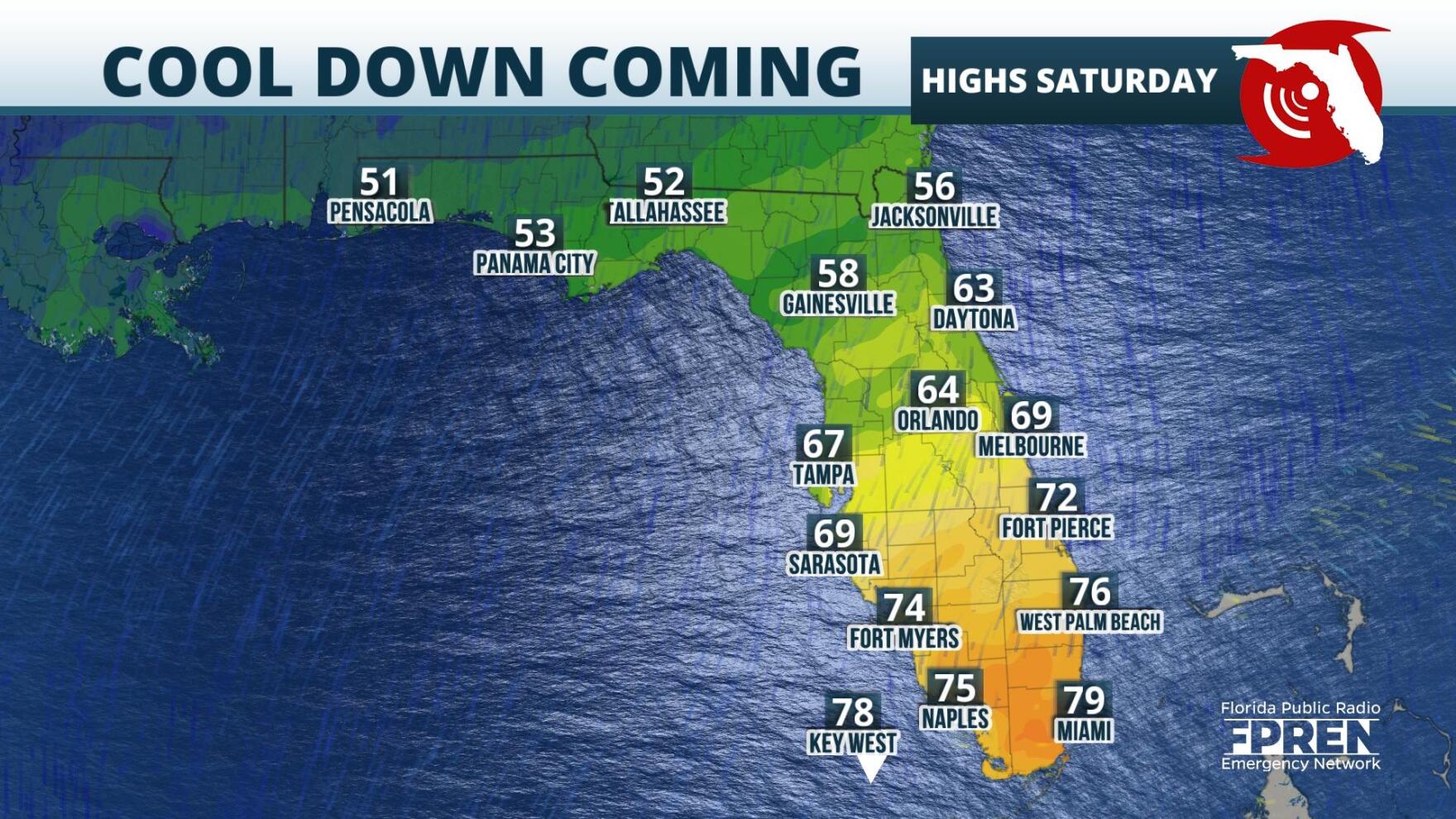
Behind the boundary, northerly winds are expected to cause a significant temperature drop across the Panhandle, North, and Central Florida. In those areas widespread highs on Thursday were in the upper 70s and lower 80s. By contrast, forecasted highs for the northern half of the state this weekend are in the low 60s and upper 50s.
The cooler pattern is expected to prevail in these regions through at least the start of the workweek, as easterly winds from the Atlantic pattern persist.
9(MDA5NDY0MjA5MDEzMzcwMjQ4MTUxZWMwMg004))


