2017 may have been the warmest year on record in Florida, but the paybacks will be frigid to start 2018.
A freeze is likely in portions of the Sunshine State each of the first seven mornings of the new year, with multiple hard freezes in a row possible north of I-4. The brutal air mass that has already cancelled New Year's Eve celebrations in dozens of states could send subfreezing temperatures as far south as Lake Okeechobee by week's end.

The winter wallop will arrive in the Florida Panhandle Sunday Night. The front will deliver a round or two of evening rain, then be followed by blustery winds and falling temperatures as the ball drops at midnight. Subfreezing temperatures are possible Monday morning near and north of a line from Panama City to Tallahassee. Wind gusts up to 25 mph will send wind chills, what it will feel like to exposed skin, into the 20s for several hours Monday morning. Elsewhere across Florida, temperatures will be closer to normal and most areas will be rain free.

The arctic front will continue heading south Monday, moving through north Florida in the morning hours and crossing the I-4 corridor (Tampa to Orlando) by midday. A downpour or two, and even a clap of thunder, is likely to mark its passage, followed by lighter periods of rain and falling temperatures. The temperature spread across Florida on the first day of 2018 will be remarkable, ranging from near freezing (during the day) near Pensacola to the lower 70s in Miami. The front will keep moving south Monday night, but likely slow to a crawl before reaching Miami.
A storm system is expected to form along the front in South Florida Tuesday, moving offshore and toward The Bahamas Wednesday. Moisture is likely to be enhanced and push further north by the area of low pressure, resulting in more widespread precipitation along and south of the I-4 corridor both days. Meanwhile, the cold air makes itself at home in north Florida and across the panhandle where subfreezing temperatures are likely both Tuesday and Wednesday morning along the entire I-10 corridor.
Arctic Air headed to FL. Jet stream takes a nose dive into central FL by Wednesday. pic.twitter.com/5azPPYIvlt
— Florida Storms (@FloridaStorms) December 30, 2017
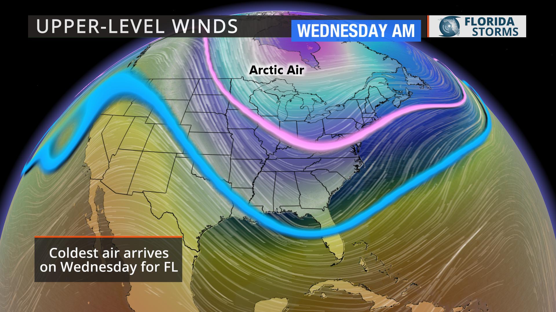 As the midweek storm system exits, this will open the floodgates for an unobstructed delivery of arctic air deep into Florida. A secondary surge from Siberia - literally the source of this air mass - will arrive Thursday and Friday, sending the possibility of a freeze this weekend all the way to the north shores of Lake Okeechobee and outskirts of Fort Myers. Temperatures are likely to be at least ten degrees below normal across the entire state, and at least half of the state will experience wind chills below 25 Friday or Saturday morning.
While it's too early to trust a credible forecast on specific low temperatures for any given location later in the week, confidence is high that the first week of 2018 will be unusually cold in Florida.


