 It takes a rare combination of events with impeccable timing to produce ice or snow, especially in Florida. First, an extremely cold air mass has to be present or at least nearby. Second, moisture has to be available in the lower and upper levels of the atmosphere. Energy and lift are then necessary for this moisture to condense and fall to the earth.
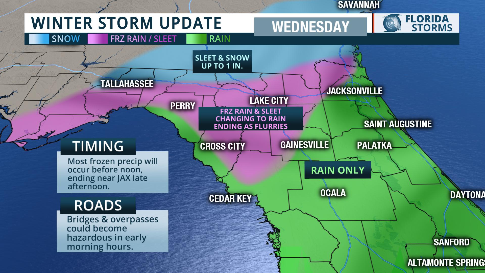
If the water droplets freeze at high altitudes, they can fall as snowflakes. If the flakes fall through a narrow layer of air that is above freezing, they might partially melt and refreeze as sleet pellets. Freezing rain occurs when the warm layer is deep enough to melt the snowflakes entirely (back to rain), but the ground temperatures are cold enough for it to freeze on contact.Cold air is already in place across North Florida. It arrived New Year's Day when temperatures fell into the 30s. Temperatures are expected to fall below freezing for the second night in a row Tuesday Night north of a line from Cross City to Gainesville to Jacksonville. This will sufficiently cool the ground for possible minor amounts of ice accumulation when precipitation moves in.
Temperatures aloft, however, are likely to stay above freezing overnight as southwest winds transport a warmer air mass in over the cold air. An area of low pressure is expected to form Tuesday night between South Florida and The Bahamas, helping to also pull moisture north into the cold air mass. Rain will likely develop quickly across north Florida just after midnight, and where temperatures are below freezing, it could freeze on contact. Elevated surfaces, bridges and overpasses could receive up to one-tenth of an inch of ice accumulation before sunrise, making travel difficult in some spots.
Air temperatures are likely to warm above freezing during the morning hours Wednesday, with most of the precipitation transitioning to a period of rain. Colder air will be surging in aloft midday, possibly making it possible for some wet snow or sleet to mix in before the precipitation exits by early afternoon. Due to the warmer ground temperatures at this time, little or no snow or sleet accumulation is expected in most areas. However, locations near the I-95 corridor from Jacksonville to the Georgia border may see a period of heavier wet snow later in the afternoon capable of cooling the air just enough for light accumulations to occur.


