February was the warmest on record in nearly all of Florida. Since then, temperatures seem to be “marching” back in time this month, a harsh reminder that winter is NOT over. At least not yet.
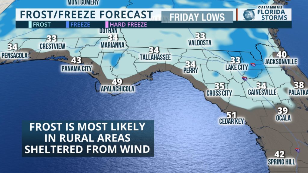
The second cold front in five days swept across the state Tuesday, producing some much-needed rain and even a few strong thunderstorms. The front is clearing South Florida today (Wednesday), opening the door for a colder air mass to settle in and linger for several days. A late-season frost is even possible across northern portions of the state by Friday morning.
 Many Floridians were wondering if there was no turning back from the relentless heat of summer. In February! Setting record highs became a daily occurrence in many cities between the 9th and 21st, and the all-time record high for the month was set in both Tampa and Sarasota on February 20th.
The first cold front over the weekend was a bit of a reality check, sending many scrambling for their sweaters and jackets. After weeks with highs in the 80s, afternoon temperatures only made it into the 60s and 70s.
The second front, the one moving through this week, is being driven by stronger upper-level winds taking a more direct aim at the Southeast. The origin of this air mass reaches further north into Canada, likely making it even colder than the recent chill. Temperatures are expected to average 10 to 15 degrees below the seasonal norms across most of the state, yielding daytime highs in the 60s to lower 70s and overnight lows in the 30s to 50s (north to south). If the winds die down Thursday night, it could be cold enough for frost generally near and north of a Tallahassee to Gainesville to Jacksonville line.
