Hurricane season is still 28 days away, but activity is churning up in the Atlantic. A non-tropical disturbance is likely to approach Florida this weekend from The Bahamas. Gusty winds and periods of heavy rain are possible as it marches across the southern portion of the state Saturday, spreading north into central and northeast Florida Sunday, before exiting Monday.
The National Hurricane Center issued a special statement on the area of low pressure Friday morning...
A Special Tropical Weather Outlook has been issued on the system near the Bahamas. While development is not expected, locally heavy rainfall and gusty winds are possible over southern Florida and the Bahamas through this weekend. https://t.co/NERCKLZFZm pic.twitter.com/x31crIbl8O
— National Hurricane Center (@NHC_Atlantic) May 4, 2018
Periods of rain will begin early Saturday morning along the Florida Atlantic coast from Ft. Pierce to West Palm Beach to Miami. During the afternoon, the downpours will spread north into central Florida near a line from Orlando to Tampa and points south.
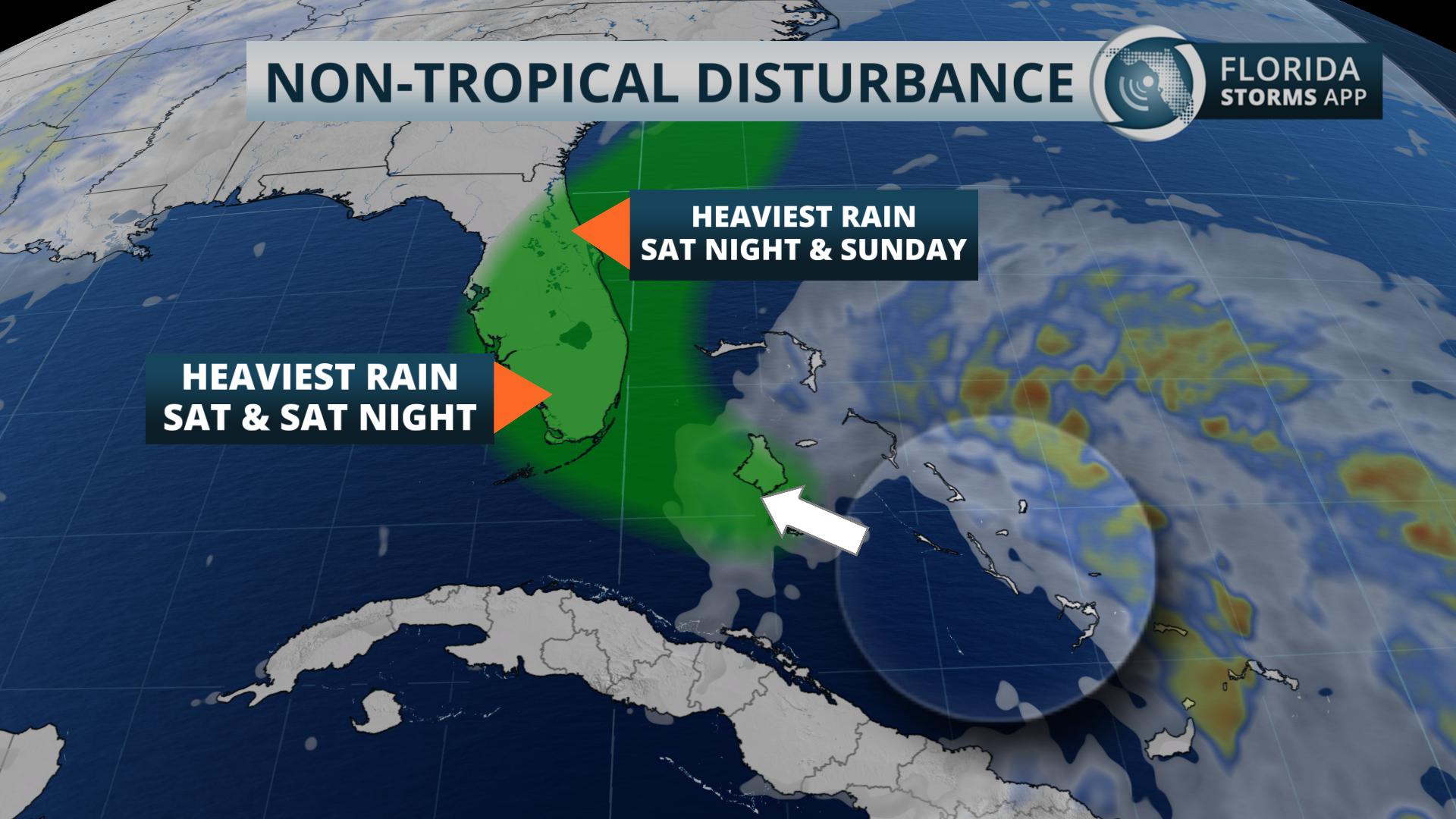
Bands of rain are expected to drift north toward Ocala, Daytona Beach and St. Augustine by Sunday morning, with pockets of heavier rain likely developing by afternoon. The western edge of the showers will move close to Gainesville and Jacksonville later in the day, but likely stall near those areas before dissipating later in the evening.
Drier weather returns to state on Monday as the disturbance moves north towards the South Caroline coast.


