Heavy rain, localized flooding, and unsettled seas are possible anywhere from coastal Louisiana to Florida over the Memorial Day weekend. A disturbance in the western Caribbean is forecast to move into the Gulf of Mexico later this week, where it could acquire tropical characteristics before drifting ashore.
In a statement Monday morning, the National Hurricane Center gave the potential system a low, or 20 percent, chance of developing into a tropical depression or storm over the next five days.Regardless of tropical development, the outcome for the State of Florida is almost certain. More rain. And lots of it.
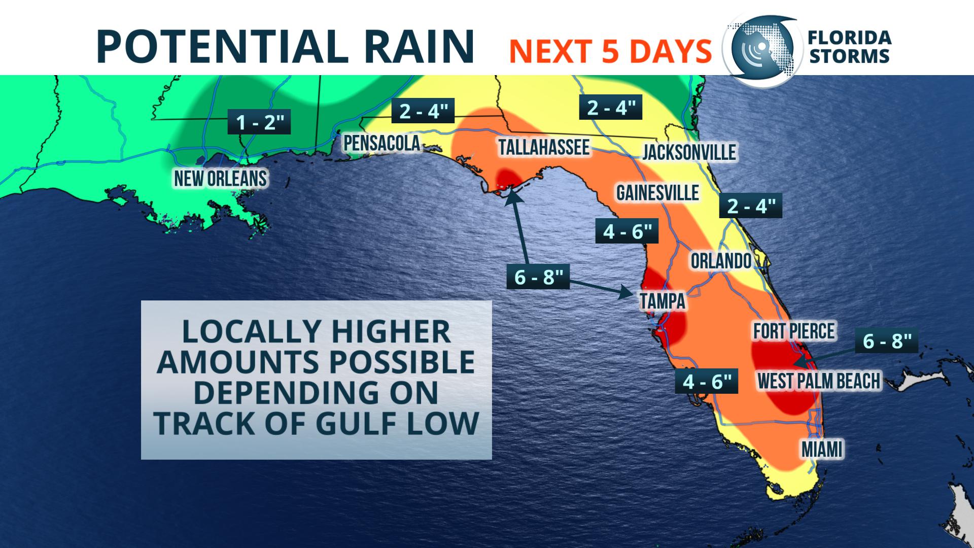
The heaviest rain will this week's potential tropical development may not occur near where it tracks. While considerable uncertainty exists as to the extent and strength of any tropical entity, the potential for heavy rain and localized flooding will be enhanced across all of Florida once the system moves into the Gulf of Mexico. This is most likely to occur Friday through Sunday, which is when the deepest moisture will be directed at the state.
As of Monday morning, forecast data suggests that nearly all of Florida will receive more than four inches of rain over the next seven days. Even higher totals, possibly exceeding six inches, could fall closer to Florida's Gulf Coast depending on the eventual track and strength of the potential tropical system. A more precise projection of when and where the heaviest rain may fall will become clearer in the days ahead.Missing from the Sunshine State has been the sun recently. A similar weather setup last week prompted an early start to the state's rainy season, and nature's faucet hasn't shut off since.
[table id=3 /]
While not purely tropical in nature, last week's pattern opened up a pipeline of tropical moisture that will continue to stream north for many days. Originating in the Caribbean Sea, the saturated air will enhance rainfall rates and coverage at times. The deep south-southeast flow will steer several rounds of showers and thunderstorms across both the panhandle and peninsula, sometimes even arriving during the atypical overnight or morning hours.
Inland, urban, and small stream flooding are the primary (and most known) hazards with this type of weather event. Residents in low-lying areas, especially those prone to flooding, are encouraged to come up with a plan should the need to evacuate arise. Motorists are urged to use caution when driving through heavy rain and be watchful for flooded roadways.


