It wouldn't be an Independence Day without nature's fireworks in Florida, right? Even though they are likely to develop by afternoon, they should clear in most spots in time for the man-made explosives.
The morning hours will be most favorable for boating, swimming and grilling across the entire state. Just make sure to drink lots of water, as the typical heat and humidity will be building quickly.
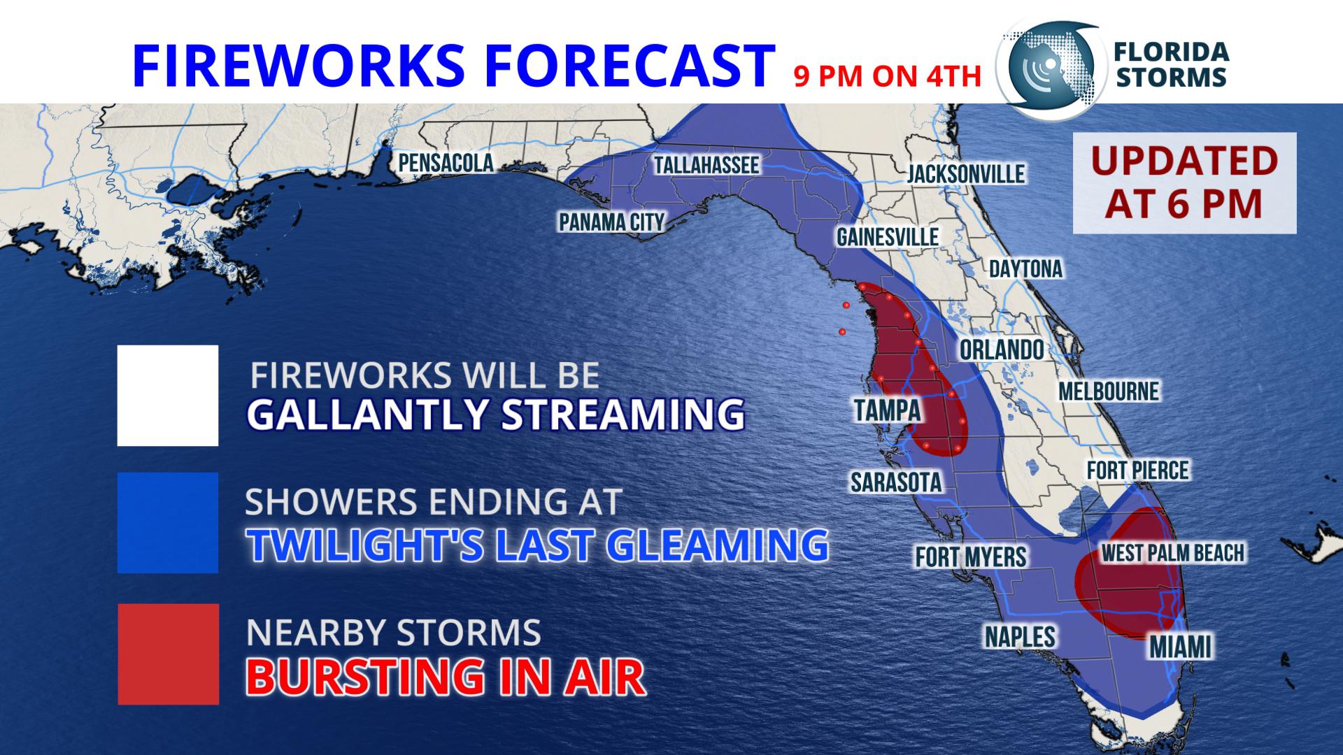 By early afternoon, thunderstorms are likely to develop and strengthen quickly along the Atlantic sea breeze as it moves inland. The strongest and most widespread storms will occur near the I-75 corridor by late afternoon, and some of then could be strong or severe across portions of North Florida. The cells will generally be moving to the west toward the Gulf coast and most of them will diminish by sunset. The highest chances of a cell or two lingering up until fireworks time is immediately near the coast from Tampa to Naples.We will update the following forecasts if necessary through late Wednesday afternoon.


