A complex of showers and thunderstorms is likely to produce heavy rain and gusty winds across portions of central Florida Wednesday afternoon and evening. While severe weather is not expected to be widespread, a few of the cells may prompt warnings for possible wind damage.
Tuesday was a soggy day across the peninsula due to a stalled front and upper-level disturbance moving along it, but the rain was mostly on light side.
That same front will still be stretched across the state again Wednesday, as another upper-level impulse approaches from the west. This one is a bit stronger though, and was already noted to be producing showers and thunderstorms across the northern Gulf of Mexico in the predawn hours Wednesday.
In addition to the widespread rain expected later today, a few stronger storms will be possible in sections of #CenFla. #flwx pic.twitter.com/Xum6toZlQk
— Florida Storms (@FloridaStorms) February 27, 2019
This area of thunderstorm activity is expected to traverse the waters of the northeastern Gulf on a trek toward the peninsula by Wednesday afternoon. The leading edge of this activity will be the strongest over the water, where wind gusts of 40 to 50 mph will be possible. This is most likely to come ashore along sections of the Nature Coast and Sun Coast from Cedar Key to Sarasota between 2 and 5 pm.
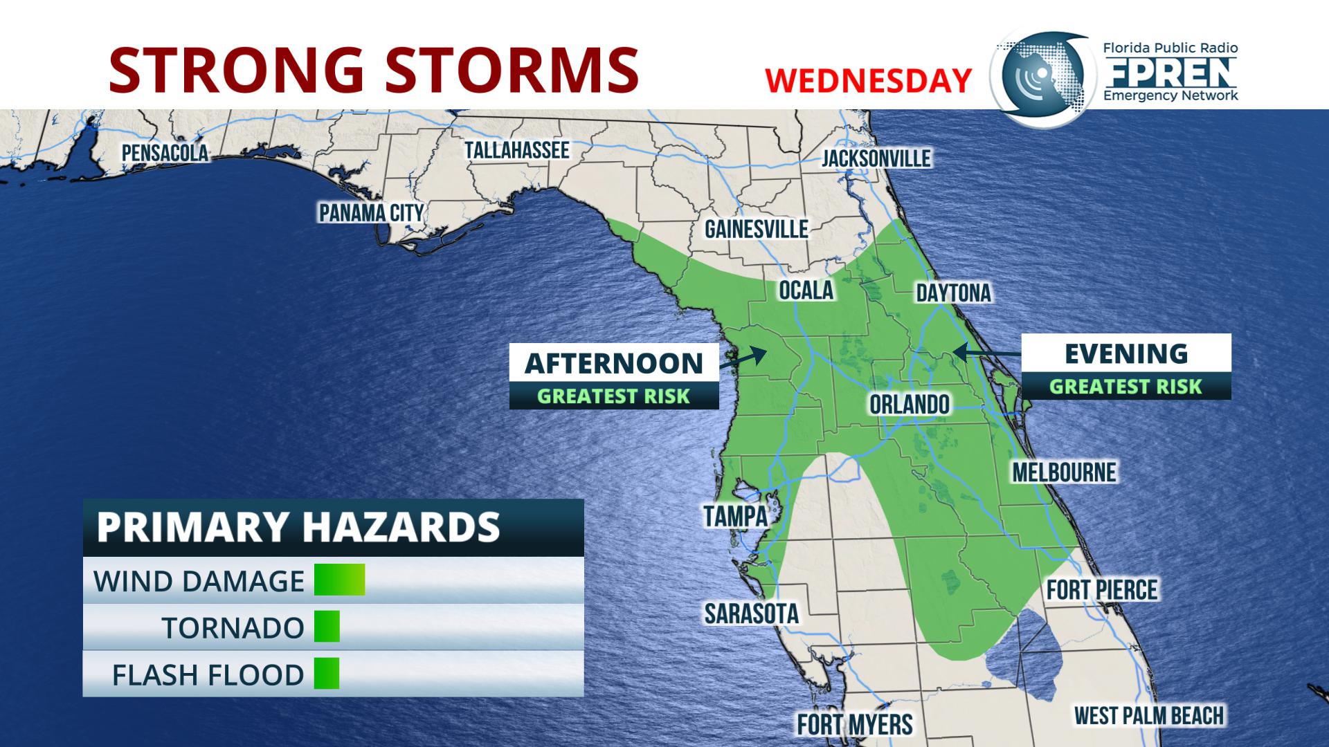
A second area of scattered thunderstorm activity is forecast to develop across inland areas of central Florida Wednesday afternoon, primarily ahead of the aforementioned complex approaching from the west. While instability parameters are fairly weak, a few of these storms may also have the potential to be produce heavy rain and gusty winds as they move east-northeast toward the Space Coast by early evening.
Elsewhere across the state, a steady light to moderate rain is expected in the midday and afternoon hours across the panhandle and sections of north Florida. Scattered showers and a few thunderstorms are also possible in South Florida Wednesday afternoon and evening, although they won't be as widespread as the activity anticipated further north. Rainfall totals from Wednesday's storm system will generally be an inch or less, but amounts could vary significantly depending on where the heavier thunderstorms develop.


