Numerous showers and thunderstorms quickly strengthening across #Jacksonville and parts of the #FirstCoast. Heavy rainfall, gusty winds, and frequent lightning with some of these storms. #flwx
📍WJCT | 🕒Now on Twitter | ❌Expires passively`
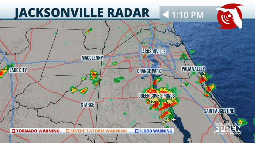
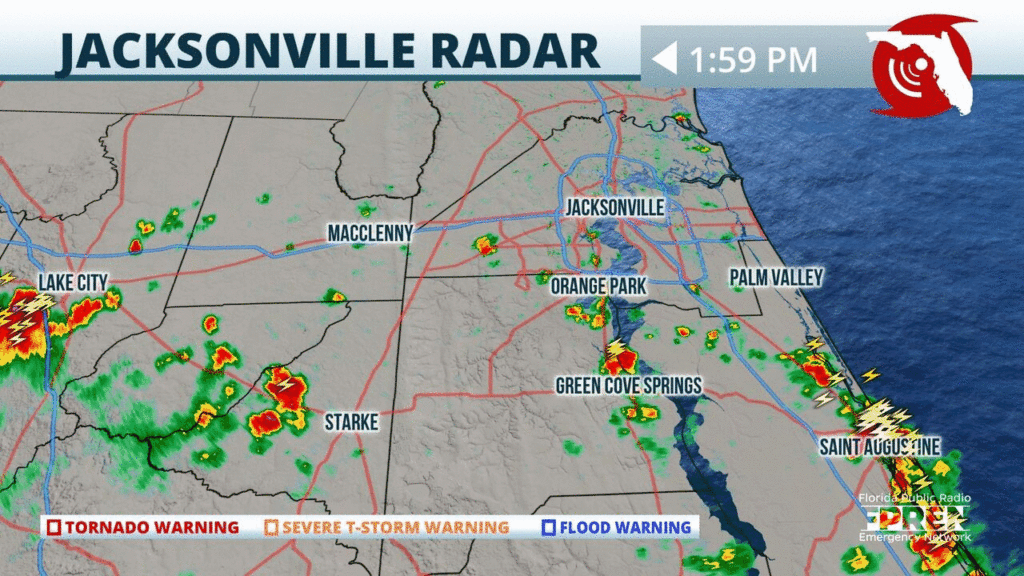
Strong t-storms are developing around #Jacksonville containing strong winds, excessive lightning, and small hail. A Severe Thunderstorm Warning is in effect for #Nassau, #Duval and #Clay County. #flwx
📍WJCT | 🕒Now on Twitter | ❌Expires passively`
Surge alerts from #Isaias: A Storm Surge Watch is in effect for the east coast of Florida from Jupiter Inlet to Ponte Vedre Beach, where 2 to 4 feet of inundation is possible.
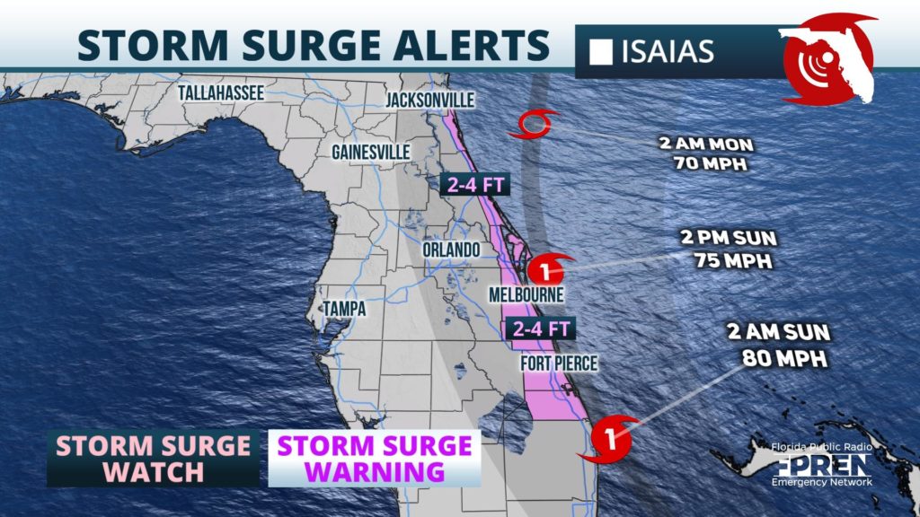
📍WJCT WMFE WFIT WQCS WXEL | 🕒Now on Twitter | ❌Expires passively`
Wind alerts from #Isaias: Hurricane Warning from Boca Raton to the Volusia/Brevard Co line. Hurricane Watch extends north to the Flagler/Volusia Co line, and south to Hallendale Beach.
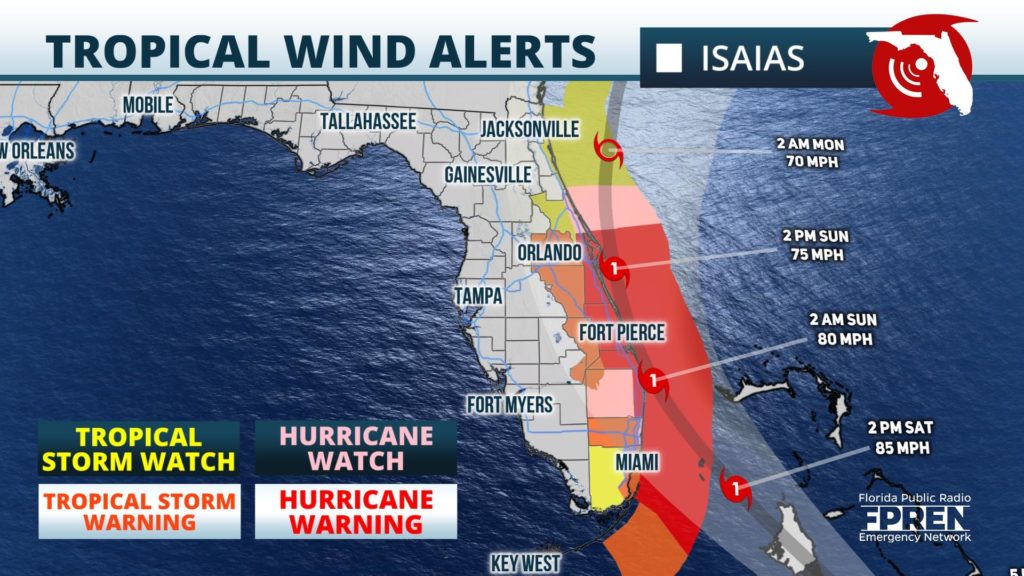
📍WJCT WMFE WFIT WQCS WXEL WLRN | 🕒Now on Twitter | ❌Expires passively`
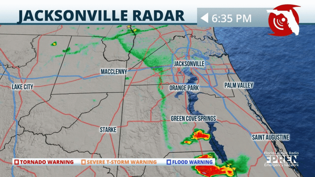
Strong thunderstorms containing heavy rainfall and frequent lightning are developing around #Jacksonville. Storms will continue to move eastward towards the Atlantic coast this evening.
📍WJCT | 🕒Now on Twitter | ❌Expires passively`
Strong thunderstorms are developing along the #FirstCoast near #Jacksonville and down towards #Saint Augustine. Heavy rainfall and excessive lightning likely. Isolated flash flooding possible. #flwx

📍WJCT | 🕒Now on Twitter | ❌Expires passively`
Thunderstorms are blossoming over the southeastern parts of #NFla. Activity will likely intensify and become more widespread inland and west this afternoon. #FLwx
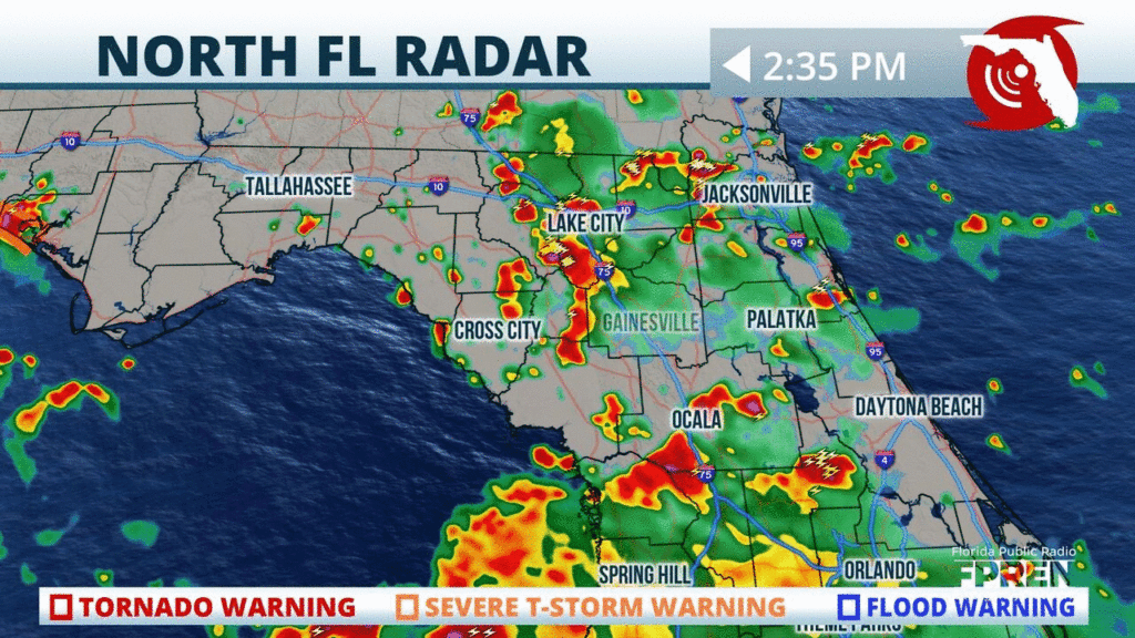
📍WJCT WUFT | 🕒Now on Twitter | ❌Expires 07/23/2020 1:00 PM`
Showers and thunderstorms are becoming widespread toward southeastern parts of #NFla. Activity will likely intensify as it tracks northwestward this afternoon. #FLwx
📍WJCT WUFT | 🕒Now on Twitter | ❌Expires 07/23/2020 12:30 PM`


