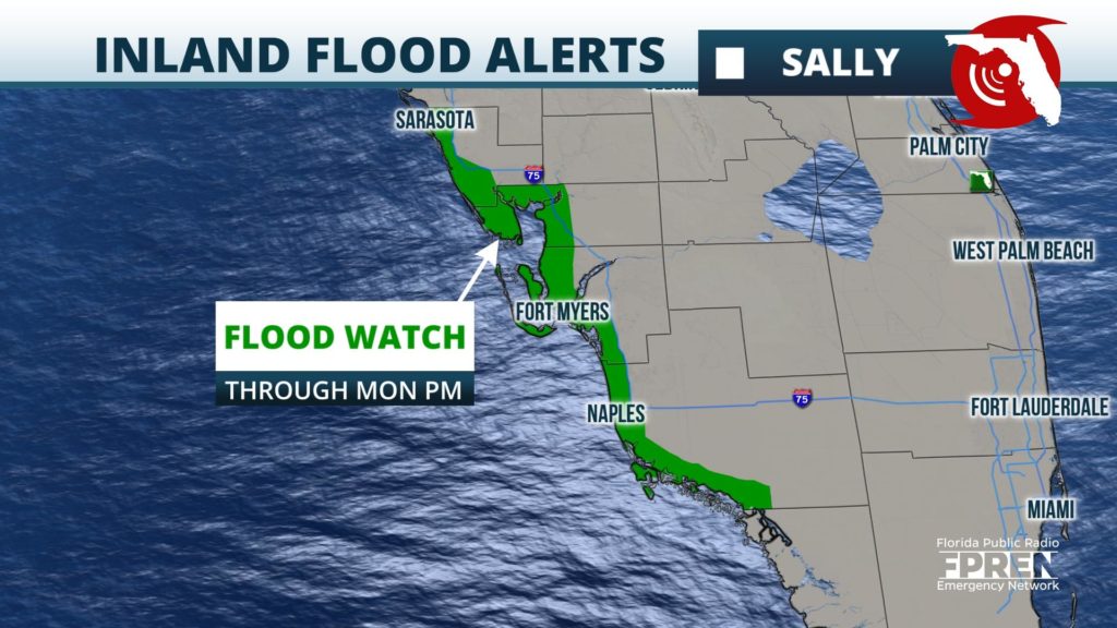
A Flood Watch continues through Monday evening for parts of #SWFL and #WCFL including the cities of #Naples, #FtMyers and #Sarasota. #Sally’s outer bands will continue to produce heavy rains. #flwx
📍WUWF WKGC WFSU | 🕒Now on Twitter | ❌Expires passively`
Hey severe thunderstorm capable of producing damaging wind gusts up to 60 mph is approaching Panama City.
📍WKGC | 🕒Now on Twitter | ❌Expires passively`
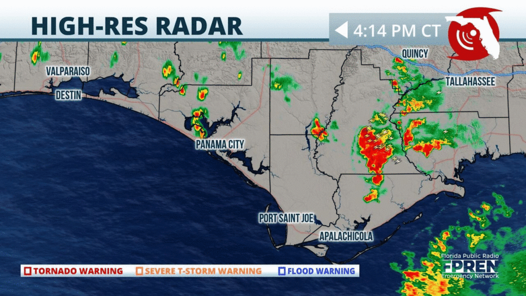
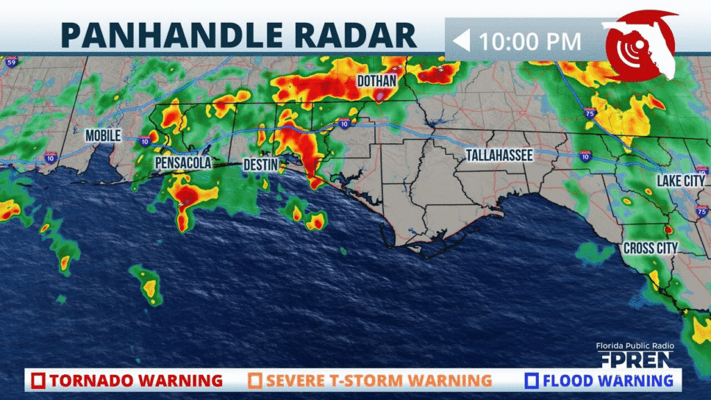
Numerous clusters of heavy rain and thunderstorms are impacting the #Panhandle, especially between #Tallahassee and #Destin this hour. As the rain continues, localized flooding will be possible. #FLwx
📍WUWF WKGC WFSU | 🕒Now on Twitter | ❌Expires passively`
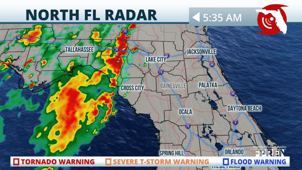
Heads up #BigBend and #NFla: A line of showers and storms has already developed and is pushing into your area from the #Panhandle. On and off t-storms will likely continue throughout the day. #FLwx
📍WUWF WKGC WFSU | 🕒Now on Twitter | ❌Expires passively`
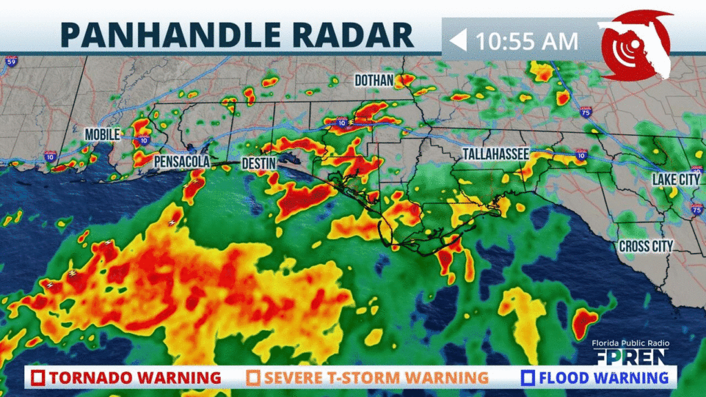
Pockets of heavy rain and gusty winds are still affecting portions of the #FLPanhandle near #Pensacola and along the #EmeraldCoast at this hour. Activity expected to wind down overnight.
📍WUWF WKGC WFSU | 🕒Now on Twitter | ❌Expires passively`
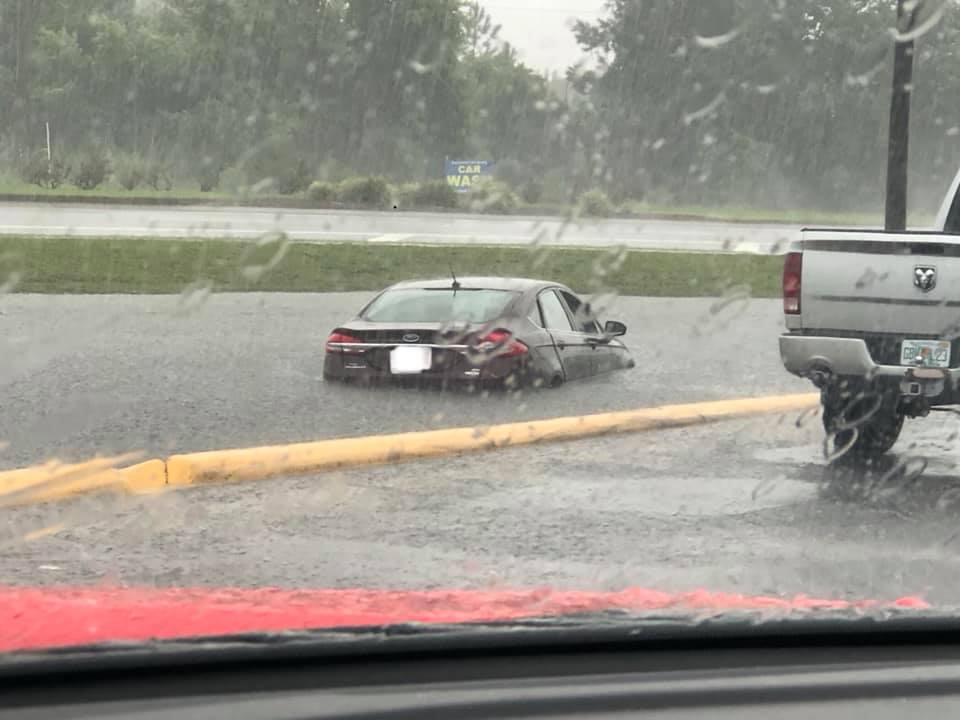
Numerous roads have been flooding near Front Beach Road and Thomas Drive in Panama City Beach. The Flash Flood Warning continues for #Bay Co until 6:45 pm CDT. Photo cred: PCB Fire #flwx
📍WKGC | 🕒Now on Twitter | ❌Expires passively`
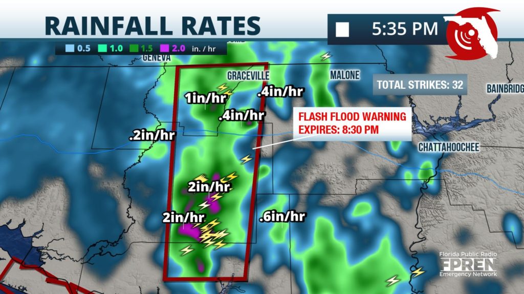
A Flash Flood Warning has been issued for parts of the #FLPanhandle until 7:30PM CDT (8:30PM EDT). Showers and t-storms have been producing heavy amounts of rainfall between 1 and 2 inches. #flwx
📍WUWF WKGC WFSU | 🕒Now on Twitter | ❌Expires passively`
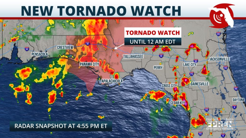
A Tornado Watch is in effect for parts of the #FLPanhandle until midnight EDT (11PM CDT). Outer bands from Tropical Storm #Marco have the potential to produce brief but powerful tornadoes. #flwx
📍WUWF WKGC WFSU | 🕒Now on Twitter | ❌Expires passively`


