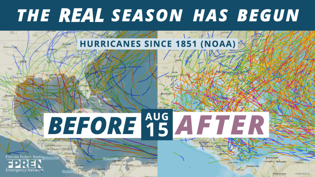
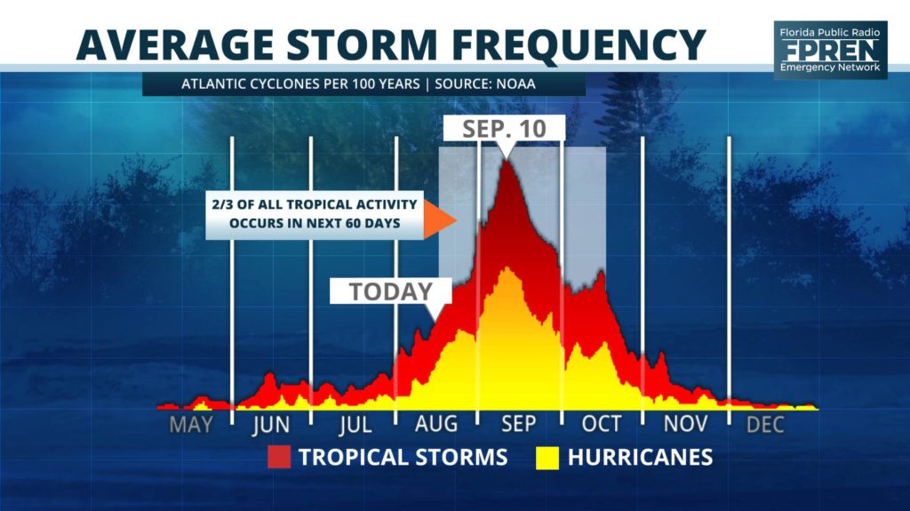
More than 85 percent of all hurricane activity in the Atlantic Basin occurs after the middle of August.
Some consider Aug. 15 as the “real” start to hurricane season. To others, like former FEMA administrator Craig Fugate, it’s synonymous with the start of football season.
Craig was Florida’s director of emergency management during the infamous 2004 season, when four hurricanes hit the Sunshine State over a period of six weeks. There were a total of 15 tropical storms or hurricanes that year, and 12 of them occurred after that date.

In this “State of the Season” report, we will discuss what the chances are the quiet season we’ve had so far will continue.
The Atlantic Basin has been quieter than normal so far this season. The Accumulated Cyclone Energy index, or ACE for short, is widely accepted in the meteorological community as a way to gauge how active the tropics have been based on the intensity, longevity, and number of tropical storms and hurricanes. As of August 15, 3.6 units of ACE have been tallied, which is less than one-third of the 12.4 units on average at this point in the season.

Subtropical Storm Andrea in late May and Hurricane Barry during the second week of July have been the only two named storms thus far. The most recent forecast has no named storms through at least August 19.
Dr. Philip Klotzbach, a well-regarded hurricane researcher at Colorado State University, found that the last time no named storms occurred between July 15 (when Barry dissipated) and August 19 was in 1982.
There are several reasons for the inactive season so far, but the largest factor is the vast amount of sinking air noted across the main development region (MDR). Tropical storms and hurricanes start from areas of clouds, showers, and thunderstorms, and the air must be rising for these storm clusters to organize into a cyclone.
In the financial world, the phrase “Past performance is not always indicative of future results” is often used as a disclaimer. This is true with hurricanes and most other weather phenomenon. Several signals indicate the 2019 Hurricane Season is about to become more active, but the level of uncertainty this year is still unusually high.

A type of wave in the atmosphere (which we wrote about in the August 1 outlook) called a convectively-coupled Kelvin wave (CCKW) can promote tropical cyclone formation if other factors are favorable. The last significant CCKW passed over the Tropical Atlantic Ocean during the last few days of July. It nearly initiated a tropical depression, but strong wind shear and sinking air behind the wave halted its development.
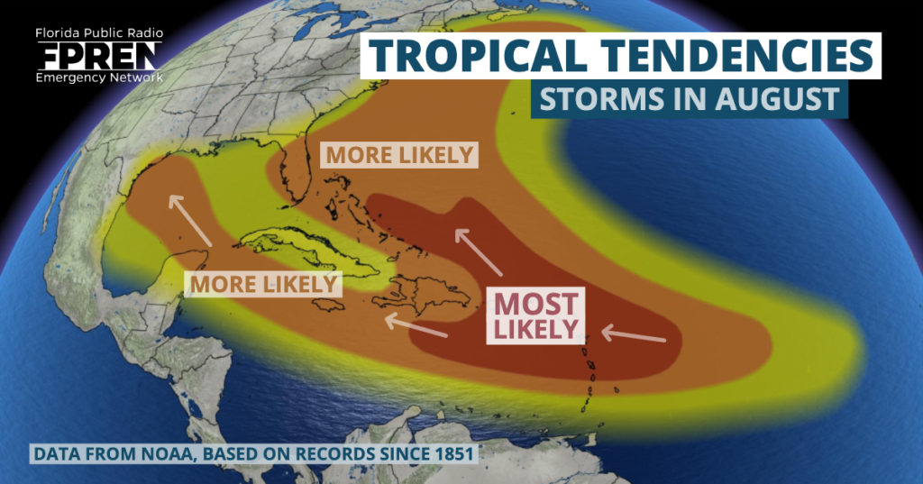
Another CCKW over the eastern Pacific Ocean is forecast to move eastward across the Atlantic during the final 10 days of the month. This wave should encourage upward motion and perhaps more development of tropical waves. Potentially coinciding with this wave, several global model simulations indicate a tropical cyclone may form somewhere in the Gulf of Mexico shortly after August 20th. It would be too early to credibly forecast such an event, but at the present time, this represents the area of greatest potential for development over the next 10 days.
Long range forecast data does not suggest tropical development will occur in the main development region soon, but it may happen near the end of the month as the CCKW begins to promote rising air over the eastern Atlantic. This could potentially aid in the organization of tropical waves over the MDR by the beginning of September.
It is nearly impossible to predict what type of impacts equatorial waves might have beyond a week or two into the future.
Warmer-than-normal water temperatures continue over much of the Atlantic. NOAA officially declared El Nino’s demise on August 8, which often results in lower wind shear. The African easterly jet and monsoon favor tropical waves moving off the continent into the Tropical Atlantic. All of these factors, in aggregate, point toward significantly more tropical storm and hurricane activity into the peak months of this season. However, it is still unclear if the seemingly ubiquitous sinking, stable air over the Atlantic will loosen its grip. This uncertainty is the largest downside risk to what could otherwise be a busy second half of the season.
