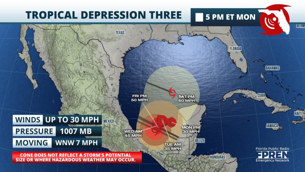
The third tropical system of the year formed Monday, which was ironically the first day of an already busy 2020 Atlantic Hurricane Season.

The National Hurricane Center began issuing advisories on Tropical Depression Three late Monday afternoon. Radar and satellite imagery were used to identify the center of circulation near the west coast of the Yucatan Peninsula, where pockets of showers and thunderstorms were rotating around it across much of Central America and southeast sections of Mexico.
As of the 5 pm EDT advisory, Tropical Depression Three was moving west-northwest at 7 mph and expected to move over the warm waters of the Bay of Campeche overnight. When it does, environmental conditions are expected to be favorable to support further intensification, and the system is likely to become a tropical storm Tuesday.
A Tropical Storm Warning was issued from Campeche to Puerto de Veracruz, Mexico with the expectation that tropical storm condition would arrive within 36 hours.
The long range forecast for what will likely become a tropical storm named Cristobal (krees-TOH-bahl) is complicated. Senior Hurricane Specialist Dan Brown said both the track and intensity forecasts are “of quite low confidence” in his notes from the Monday afternoon advisory. He outlined two potential scenarios that could play out during the latter half of the week.
One scenario, which is largely what the official forecast is based upon, keeps the storm mostly over water before it turns north-northeast and moves into the central Gulf of Mexico. The other scenario, which forecaster Brown says is “certainly possible”, is that the storm makes a southward loop over land and dissipates entirely due to the mountainous terrain of Mexico. However, in this scenario, another area of spin is noted by forecast models to be developing over the south-central Gulf of Mexico later in this week, and this could spawn a new tropical system.
Regardless of further development or which scenario plays out, residents of all Gulf Coast states in hurricane prone areas from Texas to Florida are encouraged to stay informed of the latest forecasts on Tropical Depression Three. Also, heavy rainfall will likely continue across portions of Central America over the next few days, which could cause more flash flooding.
If Cristobal forms Tuesday, it will become the earliest “C” storm on record in the Atlantic Basin. Tropical Storm Colin currently holds that record, forming on June 5, 2016 in nearly the same location Tropical Depression Three is presently. Tropical Storm Colin raced across Florida two days later, producing heavy rain and flooding in and around the Tampa metro area, and across portions of North Florida.
