Hurricane Dorian continues to be a dangerous storm, packing winds up to 185 mph and gusts over 200 mph.
Dorian's western eyewall was approaching the eastern tip of Grand Bahama Island at 7 pm.
As of 5 PM Sunday, the storm was sitting 175 miles east of West Palm Beach and had slowed down, now moving west at only 5 mph.
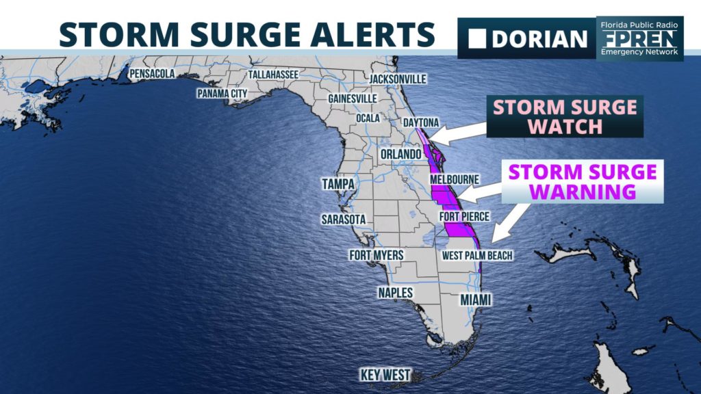
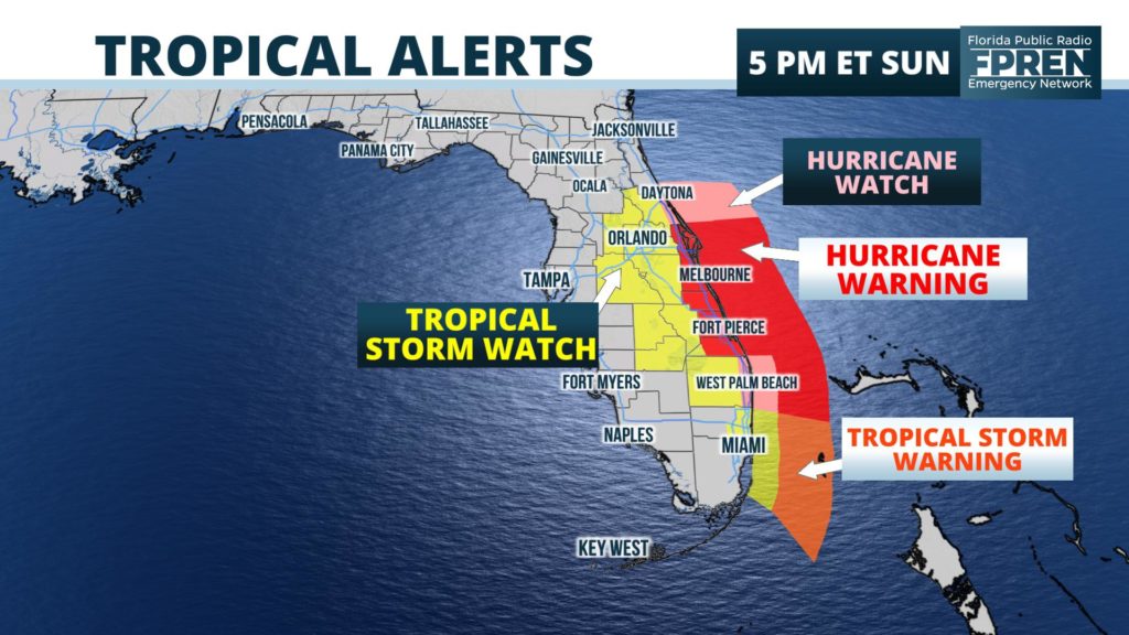
All new watches and warnings are listed below, from the National Hurricane Center.
A Storm Surge Warning has been issued from Lantana to the
Volusia/Brevard County Line.

A Storm Surge Watch has been issued from the Volusia/Brevard County
Line to the Flagler/Volusia County Line.

A Hurricane Warning has been issued from Jupiter Inlet to the
Volusia/Brevard County Line.

A Hurricane Watch has been issued from the Volusia/Brevard County
Line to the Flagler/Volusia County Line
Even though the center of Hurricane Dorian is forecast to remain offshore, Meteorologist Megan Borowski says there is an increasing chance of significant impacts.
“We’re looking at a track - and this is just the center - that’s only 30 or so miles offshore. Even though the storm might fluctuate in intensity some over the next two or three days, Dorian is expected to grow in geographic size. That’s why we’re becoming more concerned about hurricane or tropical storm conditions affecting the warned areas.”
The full official update from the National Hurricane Center is summarized below.


