Severe Thunderstorm Warning for Jacksonville, Fernandina Beach, Callahan, Jacksonville International Arpt, Unf, Arlington, Yulee,…
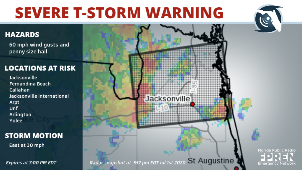
60 mph wind gusts and penny size hail possible until 7:00 PM EDT
Severe Thunderstorm Warning for Monticello, Madison, Greenville, Lee, Alma, Dills, Ebb, Lamont, Hamburg, Pinetta, Eridu, Nash, Dr…
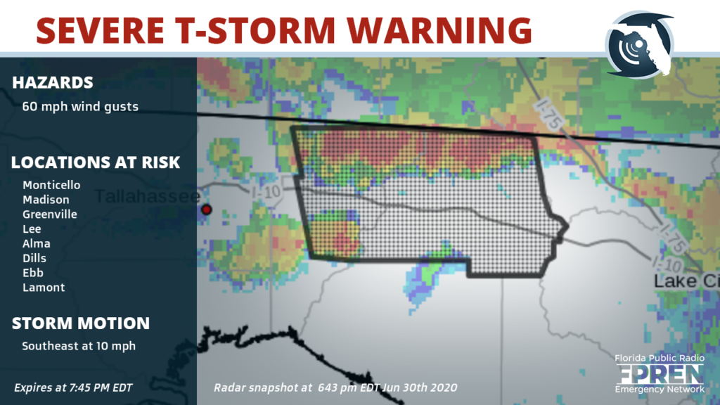
60 mph wind gusts possible until 7:45 PM EDT
Severe Thunderstorm Warning for Saint Augustine, Unf, Ponte Vedra Beach, Neptune Beach, World Golf Village, Sawgrass, Nocatee, Du…
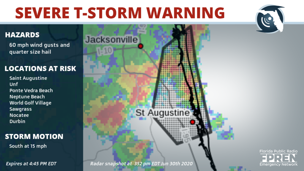
60 mph wind gusts and quarter size hail possible until 4:45 PM EDT
Severe Thunderstorm Warning for Green Cove Springs, Bostwick, Bardin, Picolata, Penney Farms, Asbury Lake and Bakersville
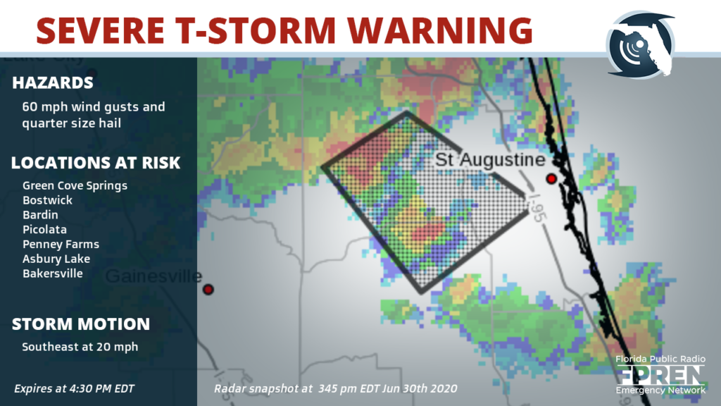
60 mph wind gusts and quarter size hail possible until 4:30 PM EDT
Severe Thunderstorm Warning for Orange Park, Mandarin, Fruit Cove, Fleming Island, Baymeadows, Ortega, Durbin, Bellair-Meadowbroo…
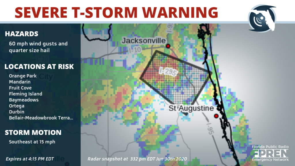
60 mph wind gusts and quarter size hail possible until 4:15 PM EDT