Two weak weather systems (other than the sea breezes) will affect the forecast across Florida this week. Both, at different times and in separate locations, will limit sunshine and produce periods of heavy rain.
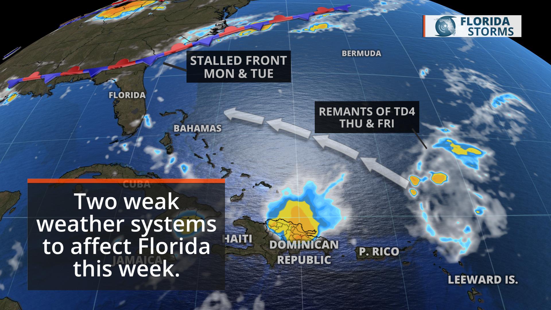
A stalled front will dissipate slowly across north Florida early in the week, acting on an area of deeper moisture already in place to produce pockets of heavy rain in the Florida Panhandle and near the Nature Coast Monday and Tuesday.
This will be followed by a brief break in the active pattern as a pocket of drier air traverses the peninsula Wednesday. For the most part, only typical spotty afternoon sea breeze showers are expected.
On Thursday and Friday, the remnant tropical moisture and energy from Tropical Depression Four will move across South Florida, leading to periods of heavy rain in spots. Some of the rain may even fall at night due the strong onshore flow from the Atlantic, especially near the coast.

Rainfall across the state this week will be highest in two distinct areas. Generally speaking, 1 to 3 inches is possible near the Nature Coast and along the I-10 corridor east of Tallahassee. Across South Florida, 2 to 3 inches of rain (mostly falling Thursday and Friday) is possible in the next five days.


