- Rare summer front moves into central Florida
- Will stall and linger for days
- Repeating rounds of heavy rain likely
A cold front doesn’t typically touch Florida from June to September. It’s not unheard of though, for one to tease the northern part of the state and bring a period of unsettled weather. However, what’s likely to happen this week is extremely rare.
[vcex_heading text=”The reason for so much rain.” style=”bottom-border-w-color” tag=”h4″ responsive_text=”true” font_weight=”semibold” text_align=”left” font_size=”18px” line_height=”1.0″ css=”.vc_custom_1501295761743{margin-bottom: 8px !important;}”]There’s usually no shortage of moisture this time of year in the Sunshine State. Throw in a cold front that can attract even more moisture, and it’s a recipe for a very wet week. Along and south of the boundary, numerous rounds of showers and thunderstorms are expected. When it’s all said and done – which isn’t very clear yet – more than four inches of rain will likely accumulate in many spots.
[vcex_heading text=”How much may fall” style=”bottom-border-w-color” tag=”h4″ responsive_text=”true” font_weight=”semibold” text_align=”left” font_size=”18px” line_height=”1.0″ css=”.vc_custom_1501301126478{margin-top: 12px !important;margin-bottom: 8px !important;}”]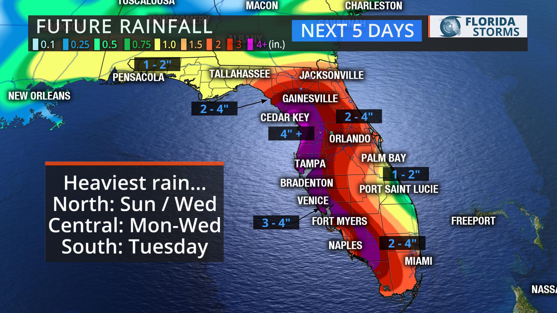
The amount of rain that falls over the next five days will vary greatly over short distances, depending largely on where the front stalls and for how long. However, confidence is high that most areas of the peninsula will see at least one or two inches by Wednesday. The highest totals will also likely occur closer to the Gulf coast, the source of the deeper tropical moisture.
Localized flooding will be possible, not only from standing water during the times of heavy rain, but also from nearby creeks and streams that might rise over their banks. The flooding potential will be higher by Tuesday and Wednesday, after multiple rounds of rain likely occur.


