The developing tropical storm near the Bahamas is likely to be mainly an Atlantic Coast event late this weekend, with most potential hazards confined to areas east of I-95.
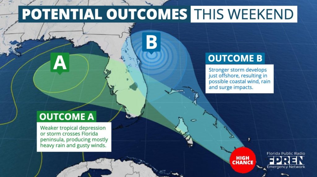
Confidence has increased that “outcome B”, as referenced in our story Thursday, will be the more likely scenario that plays out by Sunday and Monday. This outcome was defined as a “stronger storm staying just offshore”, which would allow most Floridians away from the Atlantic Coast to enjoy their weekend.
See Possible Outcome Graphic from Thursday
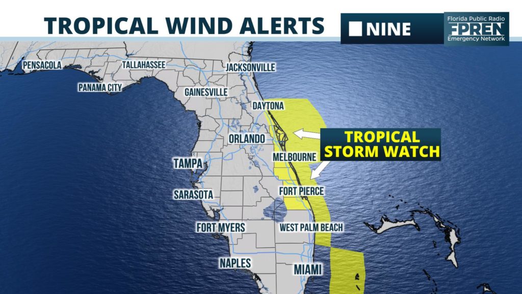
The National Hurricane Center has issued a Tropical Storm Watch from the Volusia/Flagler county line to Jupiter Inlet for the possibility that Potential Tropical Cyclone Nine might bring tropical storm conditions to those areas within 48 hours. If or when tropical storm force winds appear more likely, the watch would be upgraded to a warning.
The latest official advisory from the National Hurricane Center is provided below.
Forecast data late Thursday night and Friday morning has moved in the direction of a scenario that will leave most inland areas of Florida unaffected by the developing storm. This was unclear Thursday, as National Hurricane Center forecasters noted a “greater than normal” level of uncertainty with the potential cyclone.
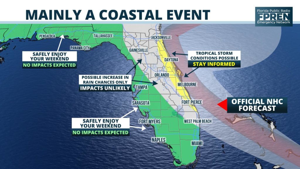
Near-normal weather conditions are now expected this weekend across the Florida Panhandle and along the western half of the peninsula, including in and around cities such as Panama City, Tampa, and Fort Myers. Farther east, generally east of the I-75 in north Florida and the Florida Turnpike in central Florida, there is a slight chance that showers and thunderstorms will become more numerous over the weekend due to the proximity of the tropical system. However, even these areas, might go mostly rain-free through the period if the more eastward forecast trends continue.
The highest chances of tropical storm force winds occurring, which are only at 30 to 40 percent according to the National Hurricane Center, are immediately along the Atlantic Coast roughly from Daytona Beach to Fort Pierce. At the present time, significant wind damage appears highly unlikely from this system anywhere in Florida. However, a persistent onshore wind from the future tropical storm will likely produce high surf, coastal flooding, and some beach erosion at all Atlantic beaches, with conditions deteriorating Saturday and worsening Sunday.
Potential Cyclone Nine (or soon-to-be Tropical Storm Humberto) is forecast to enter an environment more favorable for intensification just east of Florida Sunday and Monday, and could even become a hurricane. However, by this time, steering currents are likely to push it away from the state to the north and east. As with any developing tropical system, there is still a level of uncertainty with the forecast that justifies a constant watch for possible changes in the projected track of PTC Nine. Our team of meteorologists at the Florida Public Radio Emergency Network will provide frequent updates on this site and in the Florida Storms mobile app.


